MyTopo
Mount Zion Wisconsin US Topo Map
Couldn't load pickup availability
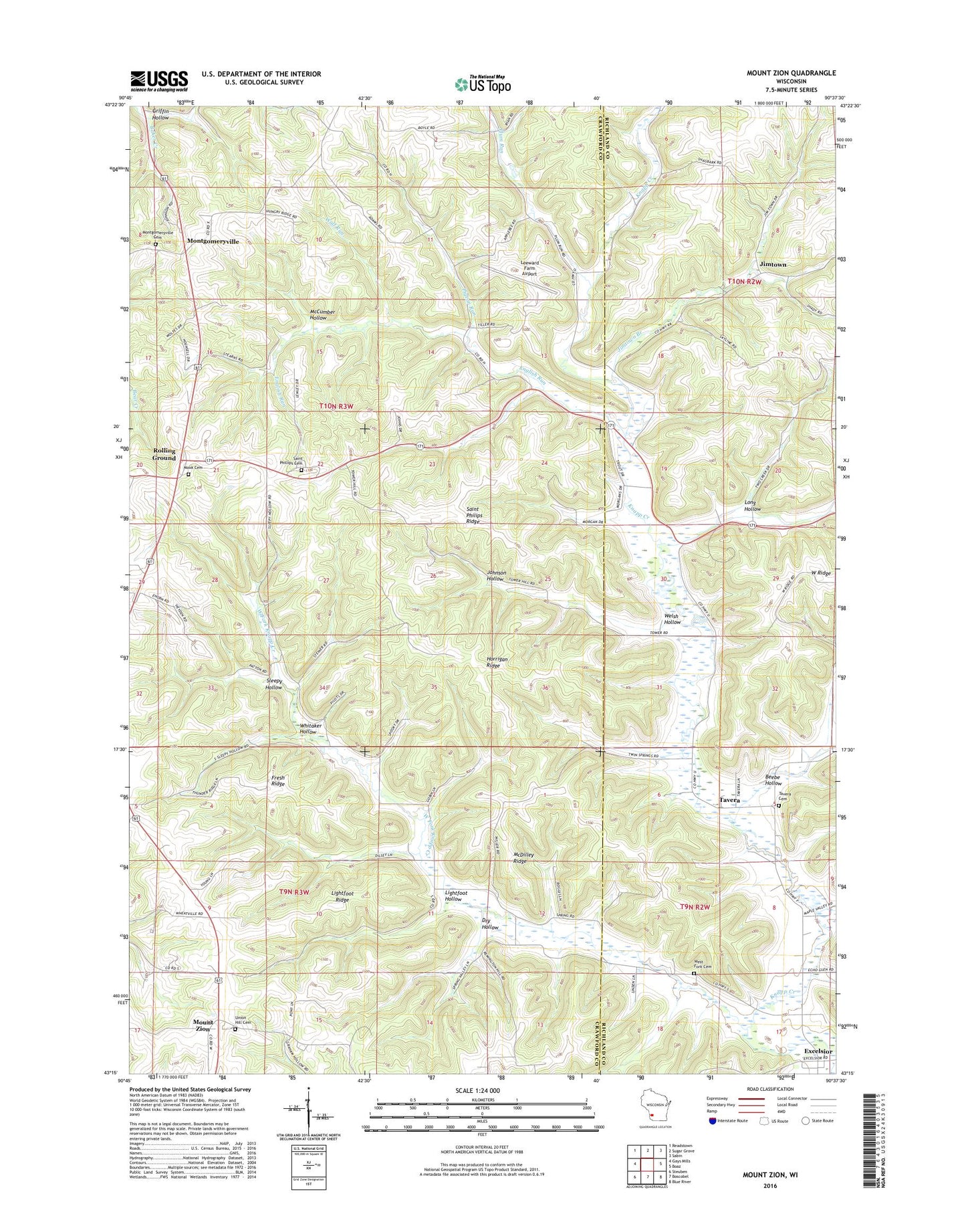
2022 topographic map quadrangle Mount Zion in the state of Wisconsin. Scale: 1:24000. Based on the newly updated USGS 7.5' US Topo map series, this map is in the following counties: Crawford, Richland. The map contains contour data, water features, and other items you are used to seeing on USGS maps, but also has updated roads and other features. This is the next generation of topographic maps. Printed on high-quality waterproof paper with UV fade-resistant inks.
Quads adjacent to this one:
West: Gays Mills
Northwest: Readstown
North: Sugar Grove
Northeast: Sabin
East: Boaz
Southeast: Blue River
South: Boscobel
Southwest: Steuben
This map covers the same area as the classic USGS quad with code o43090c6.
Contains the following named places: Beebe Hollow, Brady Stock Farm, Dry Hollow, Ellsworth Home Stock Farm, English Run, Excelsior, Excelsior School, Ferguson School, Fresh Ridge, Griffin Hollow, Grove Spring Farm, Heart Grove Farm, Hill Farm, Hillcrest Orchard, Horrigan Ridge, Jimtown, Jimtown Branch, Johnson Hollow, Leeward Farm Airport, Lightfoot Hollow, Lightfoot Ridge, Long Hollow, Lower West Fork School, McCumber Hollow, McDilley Ridge, Monk School, Montgomeryville, Montgomeryville Cemetery, Mook Cemetery, Mount Zion, Mount Zion School, Murphy School, O'Connor Branch, Orchard View School, Pigeon Run, Pleasant Ridge Farm, Plum Run, Plum Run School, Ridge View Farm, Rolling Ground, Running Brook Stock Farm, Saint Philips Church, Saint Philips Ridge, Saint Phillips Cemetery, Seward School, Sleepy Hollow, Tavera, Tavera Cemetery, Tiller School, Town of Clayton, Trout Brook Stock Farm, Turnmire Spring Farm, Union Hill Cemetery, Upper Knapp Creek School, Upper West Fork School, Welsh Hollow, West Fork Cemetery, West Fork Knapp Creek, Wheatville School, Whitaker Hollow, Wolf Run