MyTopo
Long Hollow Wisconsin US Topo Map
Couldn't load pickup availability
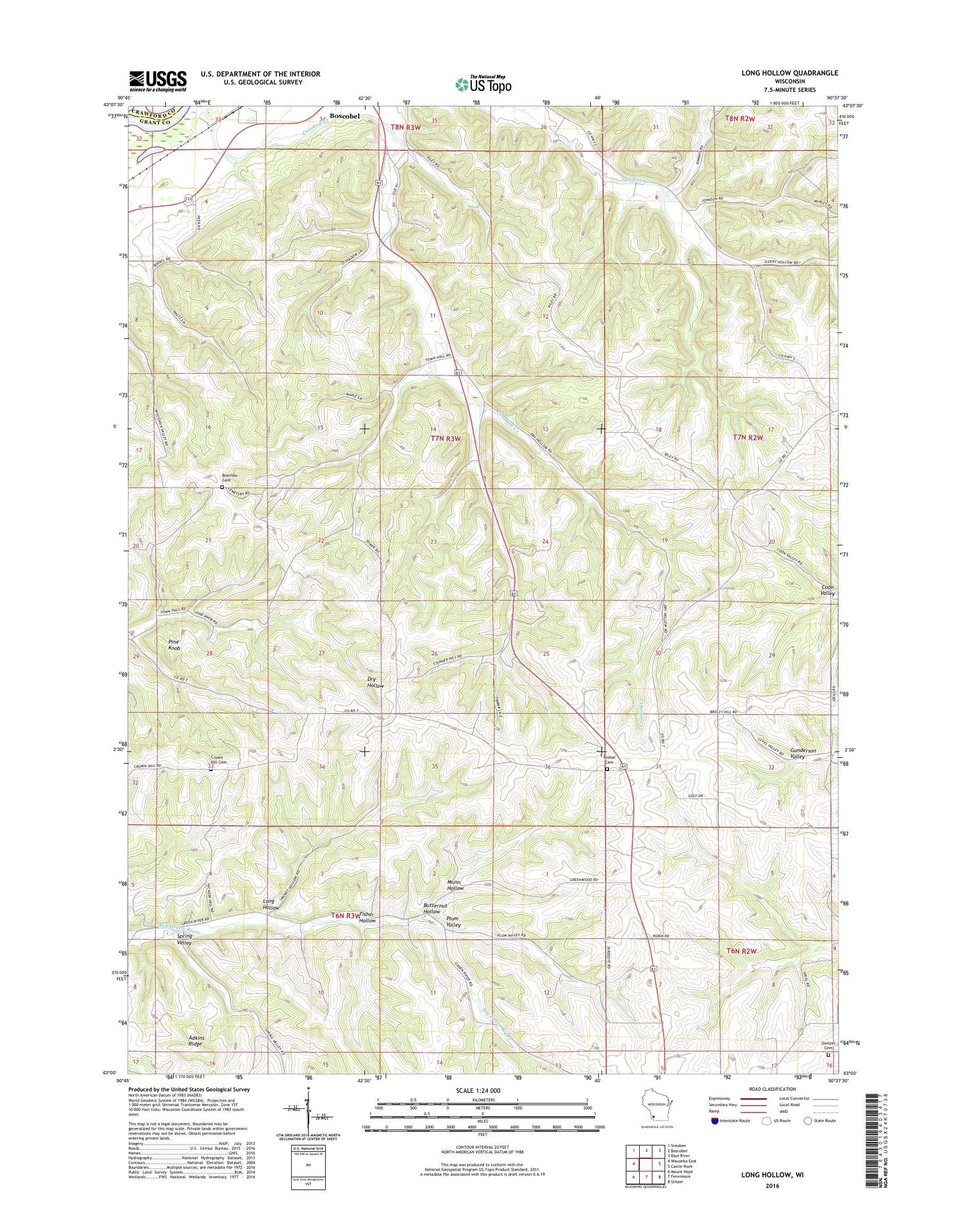
2022 topographic map quadrangle Long Hollow in the state of Wisconsin. Scale: 1:24000. Based on the newly updated USGS 7.5' US Topo map series, this map is in the following counties: Grant, Crawford. The map contains contour data, water features, and other items you are used to seeing on USGS maps, but also has updated roads and other features. This is the next generation of topographic maps. Printed on high-quality waterproof paper with UV fade-resistant inks.
Quads adjacent to this one:
West: Wauzeka East
Northwest: Steuben
North: Boscobel
Northeast: Blue River
East: Castle Rock
Southeast: Stitzer
South: Fennimore
Southwest: Mount Hope
This map covers the same area as the classic USGS quad with code o43090a6.
Contains the following named places: Adkins Ridge, Bethel Cemetery, Brechler Cemetery, Brechler School, Breezy Point School, Brindley School, Butternut Hollow, Crooked Creek School, Crown Hill Cemetery, Fisher Hollow, G and M Farms, Hickory Grove Country Club, Latham Farms, Leffler Farm, Long Hollow, Marion Church, Martin Farms, Meadow Brook Farm, Munn Hollow, Pine Knob, Plum School, Plum Valley, Rogers School, Round S Dairy, Salzgeber Quarry, Schwitzer School, Spring Valley, Switzer Cemetery, T C Farms, Town of Marion, Trumm Farm, Walker Corner