
MyTopo
Trippville Wisconsin US Topo Map
Couldn't load pickup availability
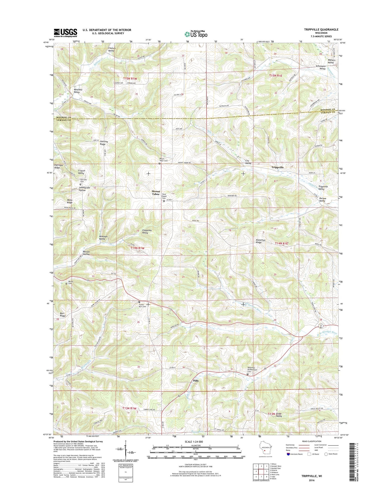
2018 topographic map quadrangle Trippville in the state of Wisconsin. Scale: 1:24000. Based on the newly updated USGS 7.5' US Topo map series, this map is in the following counties: Vernon, Monroe. The map contains contour data, water features, and other items you are used to seeing on USGS maps, but also has updated roads and other features. This is the next generation of topographic maps. Printed on high-quality waterproof paper with UV fade-resistant inks.
Quads adjacent to this one:
West: Ontario
Northwest: Wilton
North: Kendall West
Northeast: Kendall East
East: Hillsboro
Southeast: Valton
South: Yuba
Southwest: West Lima
Contains the following named places: 0.22 Reservoir, Barton Hollow, Bartons Corners, Bohemian Brotherhood Cemetery, Buff Church, Burr Wesleyan Church, Cox Valley, Dilly, Dilly Creek, Durkee Valley, Fairview Cemetery, Forest - Burr Cemetery, Knowlton Ridge, Mount Tabor, Mount Tabor Cemetery, Newman Valley, Revels Cemetery, Saint Joseph Cemetery, Schumann Valley, Stelting Ridge, Sutcliffe Corners, Town of Forest, Trippville, Trippville Valley, Walters Valley, Wesleyan Camp, Winchell Valley


