MyTopo
Kendall West Wisconsin US Topo Map
Couldn't load pickup availability
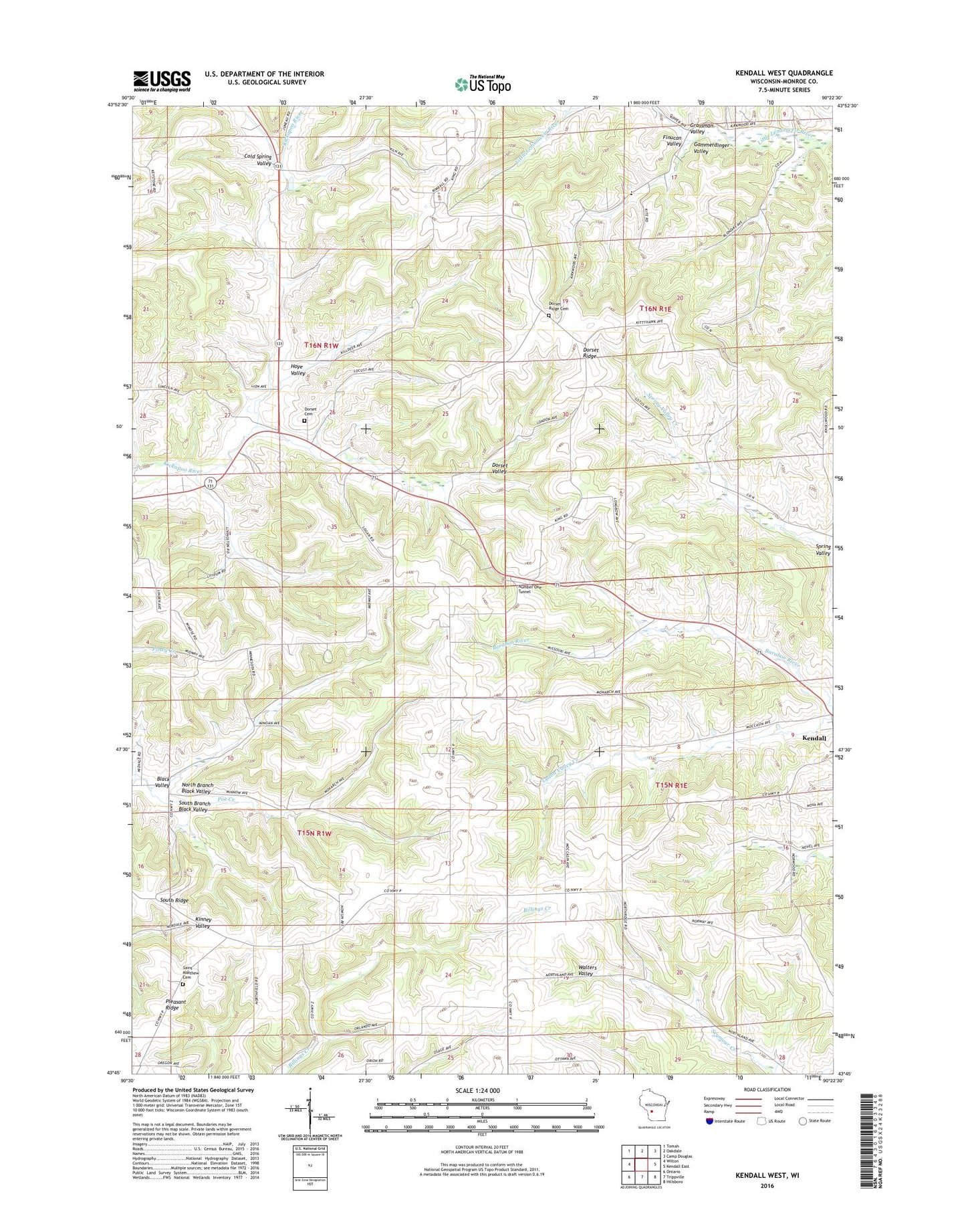
2022 topographic map quadrangle Kendall West in the state of Wisconsin. Scale: 1:24000. Based on the newly updated USGS 7.5' US Topo map series, this map is in the following counties: Monroe. The map contains contour data, water features, and other items you are used to seeing on USGS maps, but also has updated roads and other features. This is the next generation of topographic maps. Printed on high-quality waterproof paper with UV fade-resistant inks.
Quads adjacent to this one:
West: Wilton
Northwest: Tomah
North: Oakdale
Northeast: Camp Douglas
East: Kendall East
Southeast: Hillsboro
South: Trippville
Southwest: Ontario
This map covers the same area as the classic USGS quad with code o43090g4.
Contains the following named places: Black Valley School, Cold Spring School, Cold Spring Valley, Dorset Ridge, Dorset Ridge Cemetery, Dorset Ridge Church, Dorset Ridge School, Dorset Valley School, Finucan Valley, Gammerdinger Valley, Graf School, Hoffman Corners, Hoye Valley, North Branch Black Valley, Number One Tunnel, Poe Creek, Porpus Quarry, Saint Matthew Church, South Branch Black Valley, South Ridge Lutheran Cemetery, South Ridge School, Spring Valley, Sunnyvalley Parochial School, Town of Wellington, Town of Wilton, WVCX-FM (Tomah), ZIP Codes: 54638, 54670