MyTopo
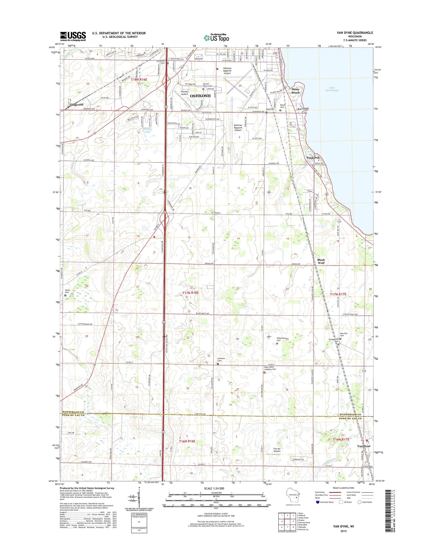
Van Dyne Wisconsin US Topo Map
Couldn't load pickup availability
2018 topographic map quadrangle Van Dyne in the state of Wisconsin. Scale: 1:24000. Based on the newly updated USGS 7.5' US Topo map series, this map is in the following counties: Winnebago, Fond du Lac. The map contains contour data, water features, and other items you are used to seeing on USGS maps, but also has updated roads and other features. This is the next generation of topographic maps. Printed on high-quality waterproof paper with UV fade-resistant inks.
Quads adjacent to this one:
West: Pickett
Northwest: Omro
North: Oshkosh
Northeast: Indian Point
East: Fahrney Point
Southeast: Fond du Lac
South: Eldorado
Southwest: Rosendale
Contains the following named places: Airborn Friesian Farm, Animal Hospital of Oshkosh, Bethany United Church of Christ, Black Oak School, Black Wolf, Boyd Cemetery, Boyd School, Bradley Egg Farm, Brennand Farm, Brick School, Clairville School, Cowham School, Ellenwood Cemetery, Fitzgerald, Fox Valley Technical College FABTECH Education Center, Fox Valley Technical College S. J. Spanbauer Aviation & Industrial Center, Fugelberg Park, Fun-Air Airport, Glatz Nature Park, Goldenrod School, Green Meadow Elementary School, Lake Aire Shopping Center, Lakeside Elementary School, Lincoln School, Manufacturers Marketplace of Oshkosh Shopping Center, Nekimi Volunteer Fire Department, New Bethel Church, New Elm Cemetery, New Elm Church, New Elm Old Cemetery, Oshkosh Country Club, Oshkosh Fire Department Station 14 - Aircraft Rescue and Fire Fighting Station, Oshkosh Post Office, Paukotuk, Peace Lutheran Cemetery, Pioneer Airport, Radtke Farm, Red School, Roe Nurseries, Roe Point, Sacred Heart Cemetery, Saint Johns Church, Saint Johns Lutheran Cemetery, Salem Cemetery, Schellers Cemetery, Smith Elementary School, Stony Beach, Town of Nekimi, Traeger Elementary School, Traeger Middle School, Twenty-Fourth Avenue Boat Ramp, Van Dyne, Van Dyne Census Designated Place, Van Dyne Post Office, Van Dyne Volunteer Fire Department, Widmer School, Wil - Dale Farms, Wilhelmina Cemetery, Wittman Regional Airport, Wood School, Zwicky Farm, ZIP Code: 54902