MyTopo
Waupun South Wisconsin US Topo Map
Couldn't load pickup availability
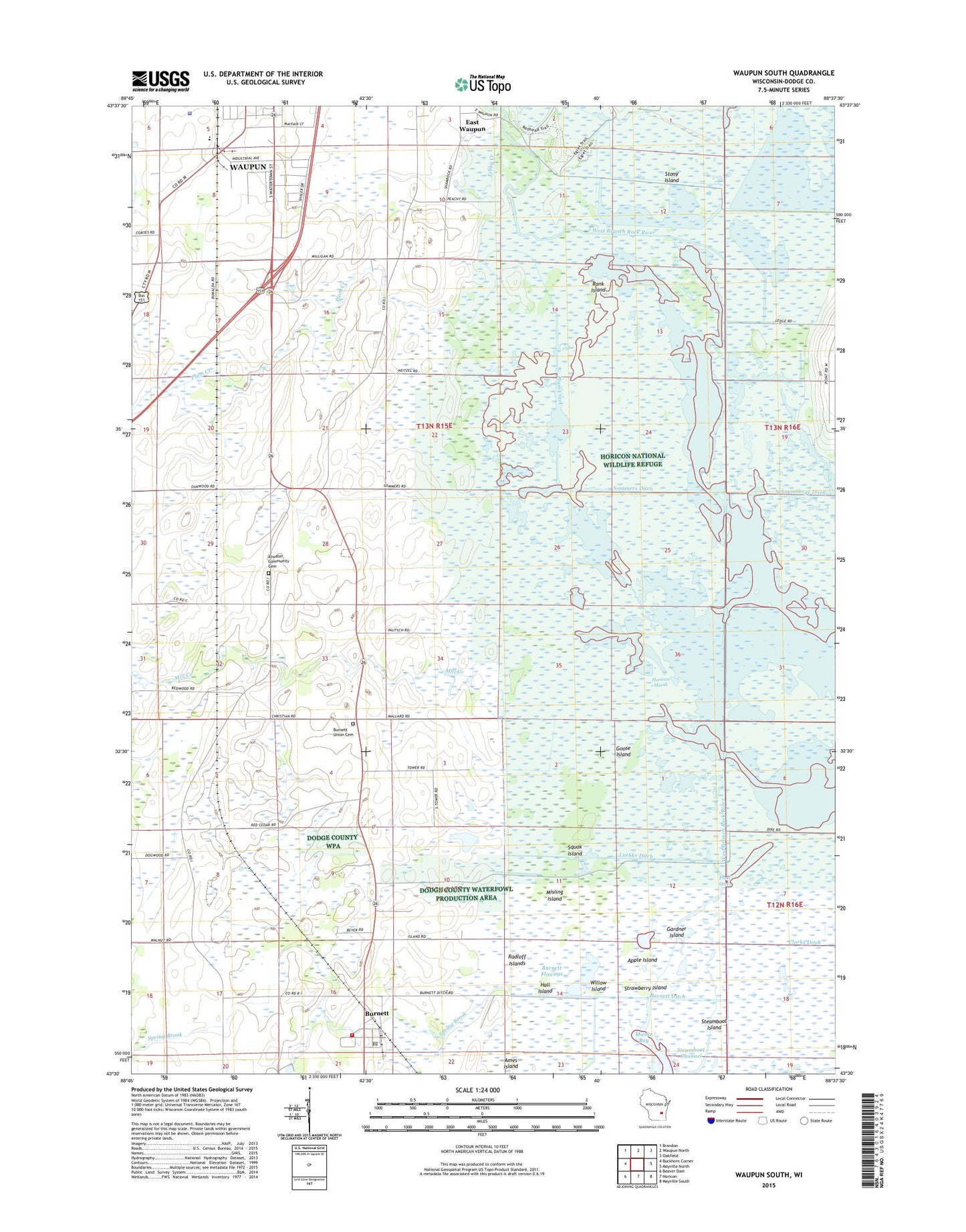
2018 topographic map quadrangle Waupun South in the state of Wisconsin. Scale: 1:24000. Based on the newly updated USGS 7.5' US Topo map series, this map is in the following counties: Dodge. The map contains contour data, water features, and other items you are used to seeing on USGS maps, but also has updated roads and other features. This is the next generation of topographic maps. Printed on high-quality waterproof paper with UV fade-resistant inks.
Quads adjacent to this one:
West: Buckhorn Corner
Northwest: Brandon
North: Waupun North
Northeast: Oakfield
East: Mayville North
Southeast: Mayville South
South: Horicon
Southwest: Beaver Dam
Contains the following named places: Ames Island, Apple Island, Atwater, Atwater Community Cemetery, Burnett, Burnett Census Designated Place, Burnett Ditch, Burnett Flowage, Burnett Post Office, Burnett Union Cemetery, Burnett Volunteer Fire Department, Central State Hospital, Chester School, Clarks Ditch, Clubhouse Ditch, Colleins Ditch, Dodge Correctional Institution, East Waupun, Elmwood School, Emmanuel Church, Gardner Island, Goose Island, Hall Island, Horicon Haven Farms, Horicon Marsh, Horicon Marsh-Burnett Dam, Horicon National Wildlife Refuge, John Burke Correctional Center School, Karstedt Park, Libby Creek, Luebke Ditch, Main Ditch, Mieske Bay, Mill Creek, Misling Island, Neitzels Ditch, Oakview School, Peachey Brothers Elevator, Plum Creek, Pool One 220, Radloff Islands, Rank Island, Schaumbergs Ditch, Sommers Ditch, Spring Brook, Squak Island, Steamboat Channel, Steamboat Island, Stony Island, Strawberry Island, Strooks Ditch, Stub Ditch, Town of Burnett, Town of Chester, Townline Ditch, Townline School, Upper Horicon 2WP629 Dam, West Branch Rock River, Willow Island, ZIP Code: 53922