MyTopo
Oakfield Wisconsin US Topo Map
Couldn't load pickup availability
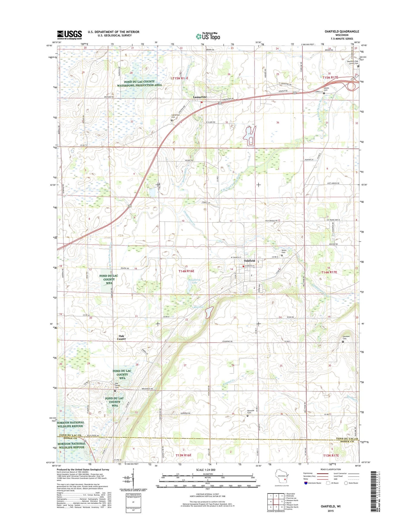
2022 topographic map quadrangle Oakfield in the state of Wisconsin. Scale: 1:24000. Based on the newly updated USGS 7.5' US Topo map series, this map is in the following counties: Fond du Lac, Dodge. The map contains contour data, water features, and other items you are used to seeing on USGS maps, but also has updated roads and other features. This is the next generation of topographic maps. Printed on high-quality waterproof paper with UV fade-resistant inks.
Quads adjacent to this one:
West: Waupun North
Northwest: Rosendale
North: Eldorado
Northeast: Fond du Lac
East: Byron
Southeast: Lomira
South: Mayville North
Southwest: Waupun South
This map covers the same area as the classic USGS quad with code o43088f5.
Contains the following named places: 1 Reservoir, 53065, Avoca Cemetery, Campground Creek, Crestledge Farms, Genesee Cemetery, Genessee School, Guenther Farm, Hawes Cemetery, Highland School, Kinwood Cemetery, Kollman Farms, Lamartine, Lamartine Cemetery, Lamartine United Methodist Church, Lamartine Volunteer Fire Department, Lamonske Farm, Ledgewind Farm, M and M Farms, Mittelstadt Landing Strip, Oak Center, Oak Center Cemetery, Oak Center School, Oak Ridge Farm, Oakfield, Oakfield Fire Department and EMS, Oakfield High School, Oakfield Ledge State Natural Area, Oakfield Police Department, Oakfield Post Office, Oakfield Quarry, Oakfield Railroad Prairie State Natural Area, Oakfield United Methodist Church, Raspberry Lake, Reynolds Elementary School, Saint James Catholic Church, Saint Lukes Lutheran Church, Saint Luke's Lutheran School, Schley E5190 Dam, Sevenmile Creek, Stone School, Town of Oakfield, Unity School, Village of Oakfield, WFDL-FM (Lomira)