MyTopo
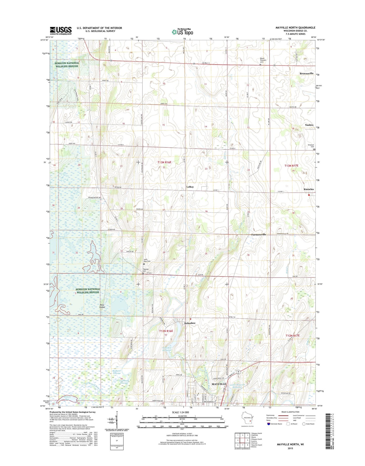
Mayville North Wisconsin US Topo Map
Couldn't load pickup availability
2022 topographic map quadrangle Mayville North in the state of Wisconsin. Scale: 1:24000. Based on the newly updated USGS 7.5' US Topo map series, this map is in the following counties: Dodge. The map contains contour data, water features, and other items you are used to seeing on USGS maps, but also has updated roads and other features. This is the next generation of topographic maps. Printed on high-quality waterproof paper with UV fade-resistant inks.
Quads adjacent to this one:
West: Waupun South
Northwest: Waupun North
North: Oakfield
Northeast: Byron
East: Lomira
Southeast: Nenno
South: Mayville South
Southwest: Horicon
This map covers the same area as the classic USGS quad with code o43088e5.
Contains the following named places: Ehrhardt Farms, Elder Grove School, Emanuel Cemetery, Emmanuel Church, Farmersville, Fink Creek, Furnace Bridge Dam, Gill Creek, Golden Grove School, Greenhead Flowage, Horicon Marsh-Greenhead Dam, Horicon Marsh-Redhead Dam, Irish Creek, Kekoskee, Kekoskee Dam, Kekoskee Millpond 182, Kekoskee Volunteer Fire Department, Knowles, Knowles Volunteer Fire Department, Lehners Ditch, LeRoy, LeRoy-Clearview School, Loduha Farm, Lower Mayville Millpond 174, Malt House Playgrounds, Malzon Bay, Mayville High School, Mayville Middle School, Mount Pleasant Cemetery, Nasbro, Oechsner Farms, Phils Island, Piepers Fruit Farm, Redhead Flowage, Rock Ledge School, Rosenkranz Farms, Saint Andrew School, Saint Paul Cemetery, School Number One, Shady Grove School, Tidyman Cemetery, Town of LeRoy, Town of Williamstown, Village of Kekoskee, WFDL-FM (Lomira), Zeigler Park, ZIP Codes: 53006, 53050