MyTopo
Winter Wisconsin US Topo Map
Couldn't load pickup availability
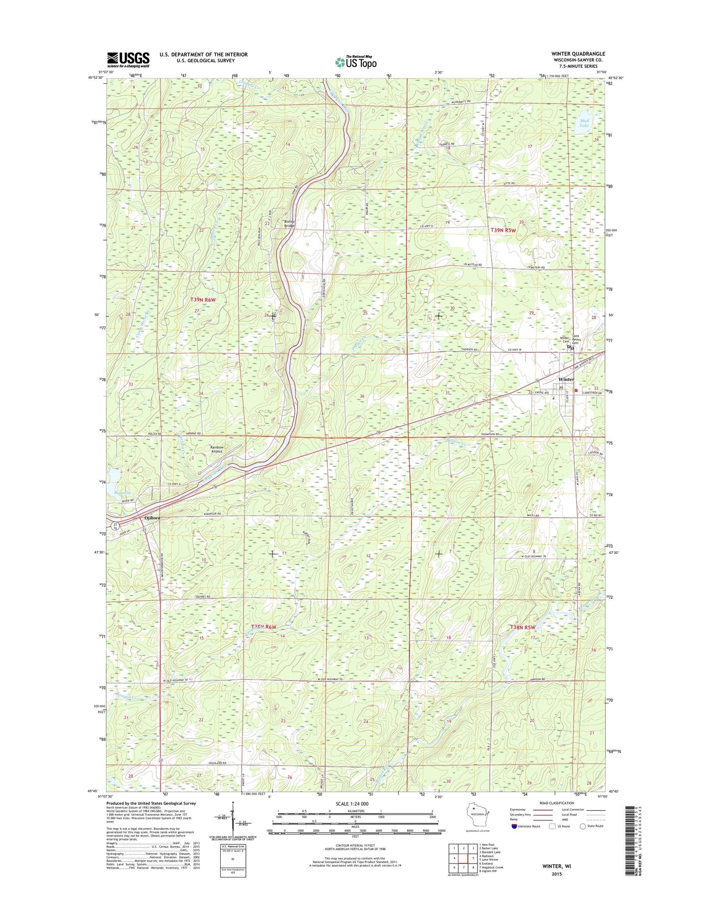
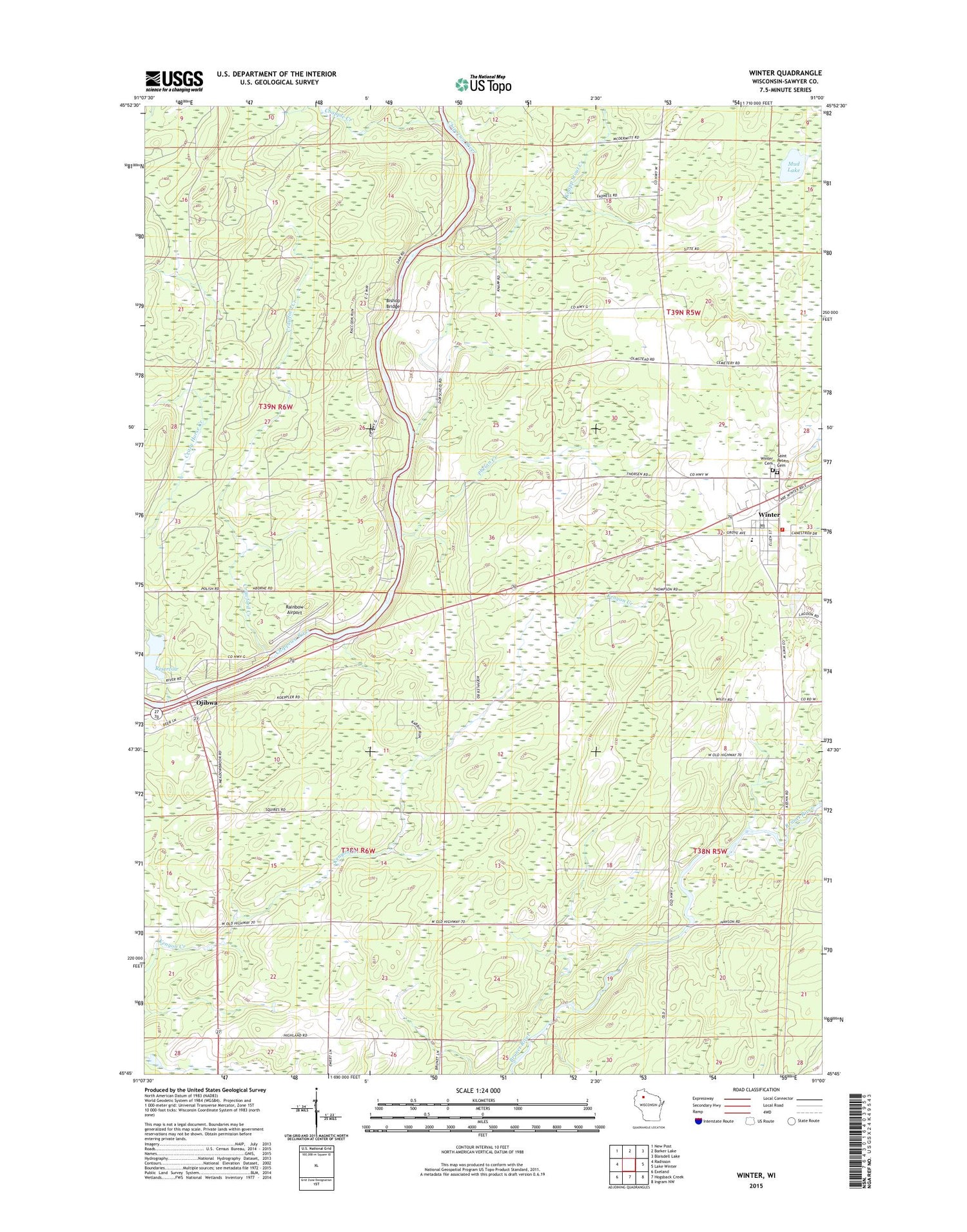
2018 topographic map quadrangle Winter in the state of Wisconsin. Scale: 1:24000. Based on the newly updated USGS 7.5' US Topo map series, this map is in the following counties: Sawyer. The map contains contour data, water features, and other items you are used to seeing on USGS maps, but also has updated roads and other features. This is the next generation of topographic maps. Printed on high-quality waterproof paper with UV fade-resistant inks.
Quads adjacent to this one:
West: Radisson
Northwest: New Post
North: Barker Lake
Northeast: Blaisdell Lake
East: Lake Winter
Southeast: Ingram NW
South: Hogsback Creek
Southwest: Exeland
Contains the following named places: Bishop Bridge, Bishop Bridge School, Chapple Creek, Crawford Creek, Crazy Horse Creek, Crazy Horse Creek Dam, Deadman Creek, Doc Smith Park, Evangelical Free Church, Knapp Stout Creek, Mud Lake, Ojibwa, Ojibwa State Park, Phelan Creek, Rainbow Airport, Saint Peters Catholic Church, Saint Peter's Cemetery, Sawyer County Emergency Ambulance Service Winter Station, Tice Public Library, Town of Ojibwa, Tuscobia Park Falls State Trail, Village of Winter, Winter, Winter Cemetery, Winter Elementary School, Winter High School, Winter Middle School, Winter Post Office, Winter Village Hall, Winter Volunteer Fire Department