MyTopo
Blaisdell Lake Wisconsin US Topo Map
Couldn't load pickup availability
Also explore the Blaisdell Lake Forest Service Topo of this same quad for updated USFS data
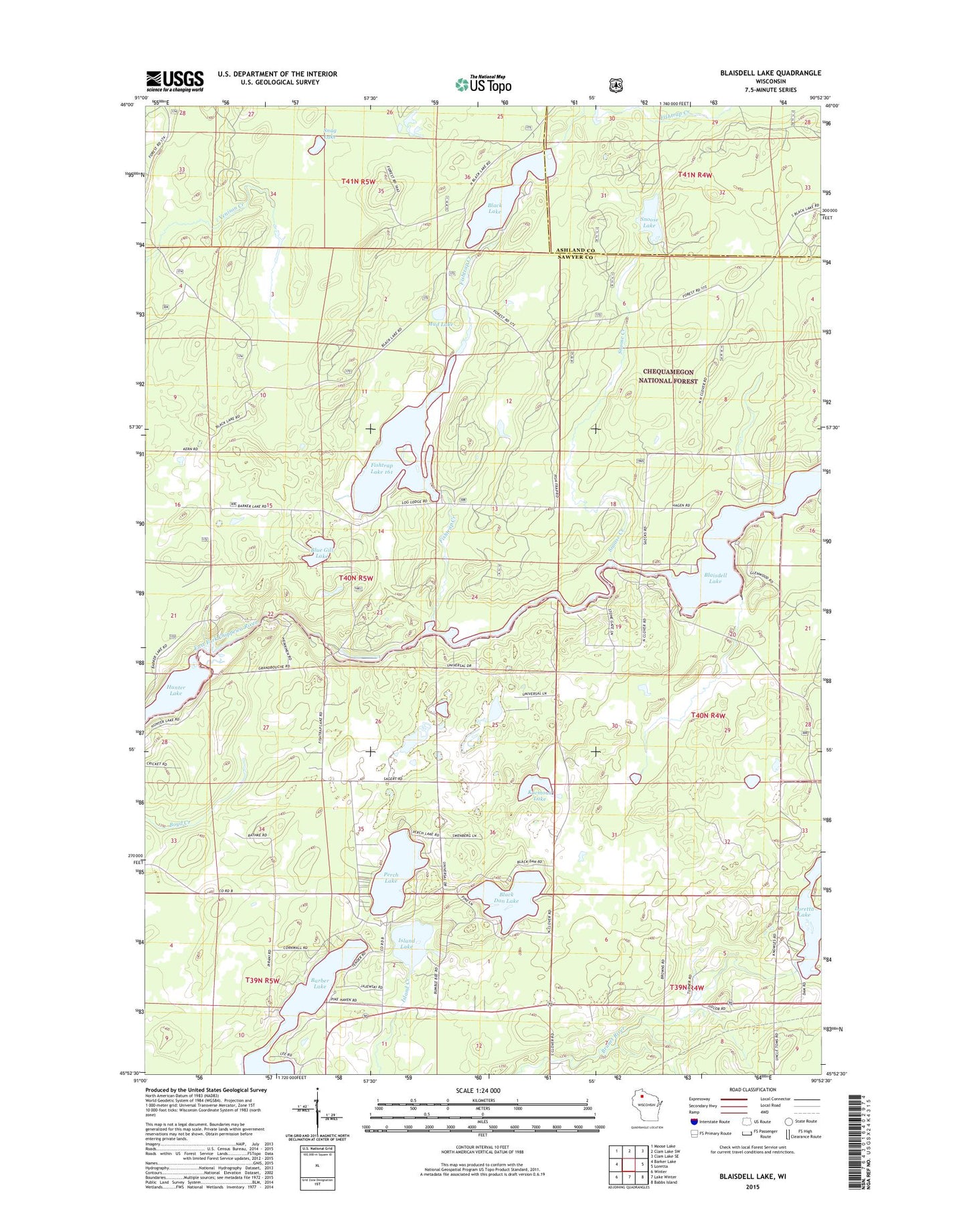
2022 topographic map quadrangle Blaisdell Lake in the state of Wisconsin. Scale: 1:24000. Based on the newly updated USGS 7.5' US Topo map series, this map is in the following counties: Sawyer, Ashland. The map contains contour data, water features, and other items you are used to seeing on USGS maps, but also has updated roads and other features. This is the next generation of topographic maps. Printed on high-quality waterproof paper with UV fade-resistant inks.
Quads adjacent to this one:
West: Barker Lake
Northwest: Moose Lake
North: Clam Lake SW
Northeast: Clam Lake SE
East: Loretta
Southeast: Babbs Island
South: Lake Winter
Southwest: Winter
This map covers the same area as the classic USGS quad with code o45090h8.
Contains the following named places: 235 Reservoir, Barber Lake, Barber Lake School, Black Dan Lake, Black Lake, Black Lake 4, Black Lake Campground, Black Lake Dam, Black Lake Fire Tower, Black Lake Trail, Blaisdell Lake, Blue Gill Lake, Brunet Flowage 30, Fishtrap Creek, Fishtrap Lake, Fishtrap Lake 161, Fishtrap Lake Dam, Glenwood Camp, Hunter Lake, Island Lake, Kocmoud Lake, Loretta Lake, Mud Lake, Perch Lake, Snag Lake, Snoose Creek, Snoose Lake, Thompson Pit, Upper Brunet 2 WP 400 Dam, We Ha Kee Church Camp, Winter 2WP806 Dam