MyTopo
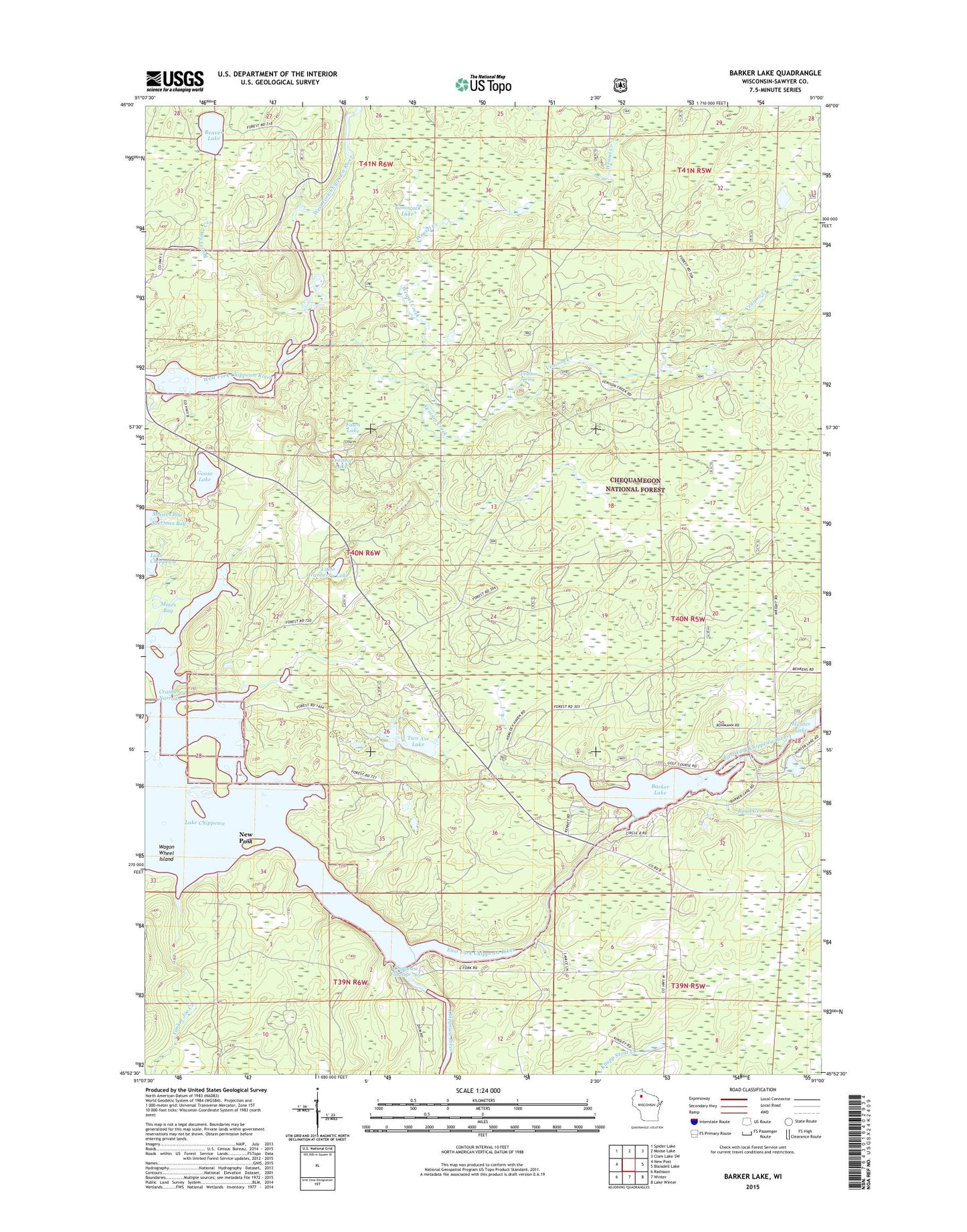
Barker Lake Wisconsin US Topo Map
Couldn't load pickup availability
Also explore the Barker Lake Forest Service Topo of this same quad for updated USFS data
2022 topographic map quadrangle Barker Lake in the state of Wisconsin. Scale: 1:24000. Based on the newly updated USGS 7.5' US Topo map series, this map is in the following counties: Sawyer. The map contains contour data, water features, and other items you are used to seeing on USGS maps, but also has updated roads and other features. This is the next generation of topographic maps. Printed on high-quality waterproof paper with UV fade-resistant inks.
Quads adjacent to this one:
West: New Post
Northwest: Spider Lake
North: Moose Lake
Northeast: Clam Lake SW
East: Blaisdell Lake
Southeast: Lake Winter
South: Winter
Southwest: Radisson
This map covers the same area as the classic USGS quad with code o45091h1.
Contains the following named places: Barker Lake, Beaver Lake, Beaver Lake Creek, Boyd Creek, Chippewa Lake, Cranberry Lake, Cranberry Narrows, East Fork Chippewa River, Fawn Lake, Goose Lake, Little Cranberry Lake, Moses Bay, Tamarack Lake, Two Axe Lake, Venison Creek, Venison Lake, Venison Spring, Wagon Wheel Island, Weasel Creek, Winter Dam, Yankee Joe Creek