MyTopo
Wonewoc Wisconsin US Topo Map
Couldn't load pickup availability
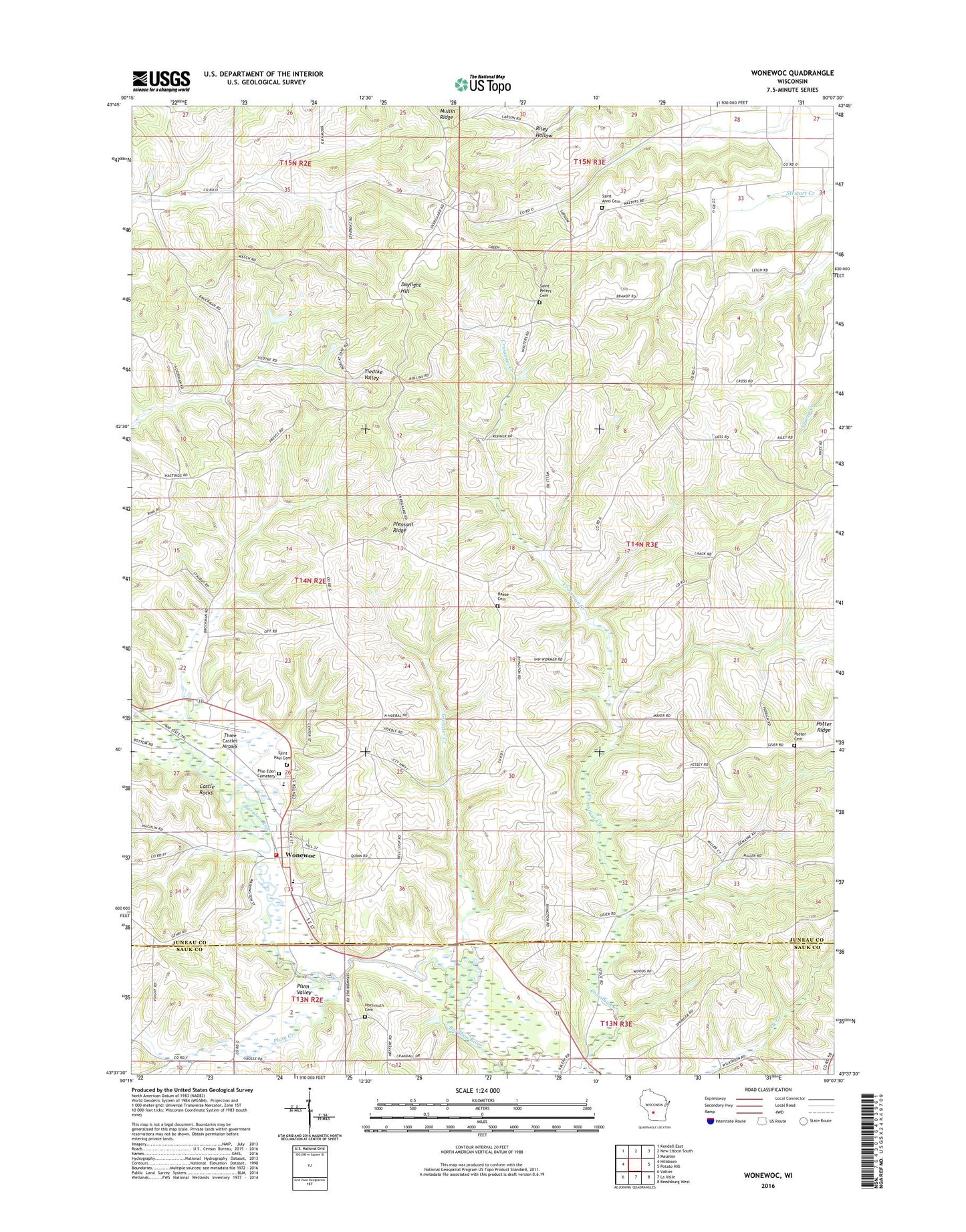
2022 topographic map quadrangle Wonewoc in the state of Wisconsin. Scale: 1:24000. Based on the newly updated USGS 7.5' US Topo map series, this map is in the following counties: Juneau, Sauk. The map contains contour data, water features, and other items you are used to seeing on USGS maps, but also has updated roads and other features. This is the next generation of topographic maps. Printed on high-quality waterproof paper with UV fade-resistant inks.
Quads adjacent to this one:
West: Hillsboro
Northwest: Kendall East
North: New Lisbon South
Northeast: Mauston
East: Potato Hill
Southeast: Reedsburg West
South: La Valle
Southwest: Valton
This map covers the same area as the classic USGS quad with code o43090f2.
Contains the following named places: .15 Reservoir, 0.5 Reservoir, 1 Reservoir, 53968, Alton School, Castle Rocks, Cherney Farms, Cusick Number 1 G3448 Dam, Cusick Number 2 G 3448 Dam, Daylight Hill, Elroy Quarry, Gardner Creek, Hochmuth Cemetery, Leverenz H 35 Dam, Mullin Ridge, Pine Eden Cemetery, Pleasant Ridge, Pleasant Ridge School, Plum Creek, Plum Valley, Potter Cemetery, Potter Ridge, Potter School, Raese Cemetery, Red School, Saint Anns Cemetery, Saint Jerome Church, Saint Paul Cemetery, Saint Paul's Evangelical Lutheran School, Saint Peters Cemetery, Three Castles Airpark, Town of Summit, Village of Wonewoc, Walsh H2198 Dam, Wonewoc, Wonewoc - Center Elementary School, Wonewoc - Center Junior High School, Wonewoc - Center School District, Wonewoc Fire Department, Wonewoc Police Department, Wonewoc Post Office