MyTopo
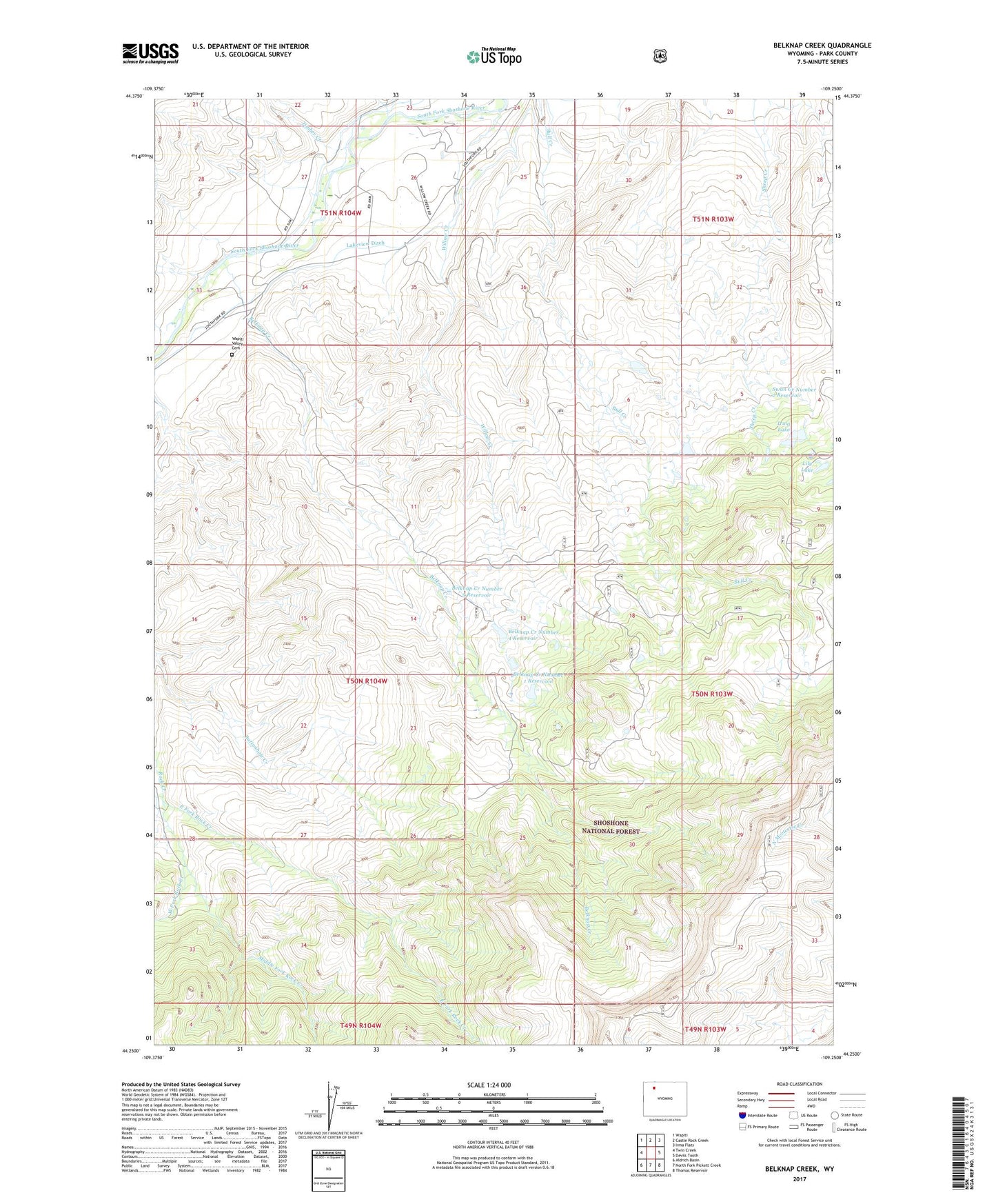
Belknap Creek Wyoming US Topo Map
Couldn't load pickup availability
Also explore the Belknap Creek Forest Service Topo of this same quad for updated USFS data
2021 topographic map quadrangle Belknap Creek in the state of Wyoming. Scale: 1:24000. Based on the newly updated USGS 7.5' US Topo map series, this map is in the following counties: Park. The map contains contour data, water features, and other items you are used to seeing on USGS maps, but also has updated roads and other features. This is the next generation of topographic maps. Printed on high-quality waterproof paper with UV fade-resistant inks.
Quads adjacent to this one:
West: Twin Creek
Northwest: Wapiti
North: Castle Rock Creek
Northeast: Irma Flats
East: Devils Tooth
Southeast: Thomas Reservoir
South: North Fork Pickett Creek
Southwest: Aldrich Basin
This map covers the same area as the classic USGS quad with code o44109c3.
Contains the following named places: Belknap Creek, Belknap Creek Number 1 Dam, Belknap Creek Number 1 Reservoir, Belknap Creek Number 4 Dam, Belknap Creek Number 4 Reservoir, Belknap Creek Number 5 Dam, Belknap Creek Number 5 Reservoir, Belknap Ranch, Big Wind Mine, Carter Mountain Weather Station, Coe Lodge, Deer Creek, East Fork Rock Creek, Irma Lake, Irma Lake Dam, Jordan Creek, Lakeview Ditch, Lily Lake, Middle Fork Rock Creek, Pelcher Ranch, Swan Creek Number 2 Dam, Swan Creek Number 2 Reservoir, Swan Creek Number 7 Dam, Swan Creek Number 7 Reservoir, Timber Creek, Wapiti Valley Cemetery, West Fork Rock Creek, Willow Creek