
MyTopo
Antelope Wash Wyoming US Topo Map
Couldn't load pickup availability
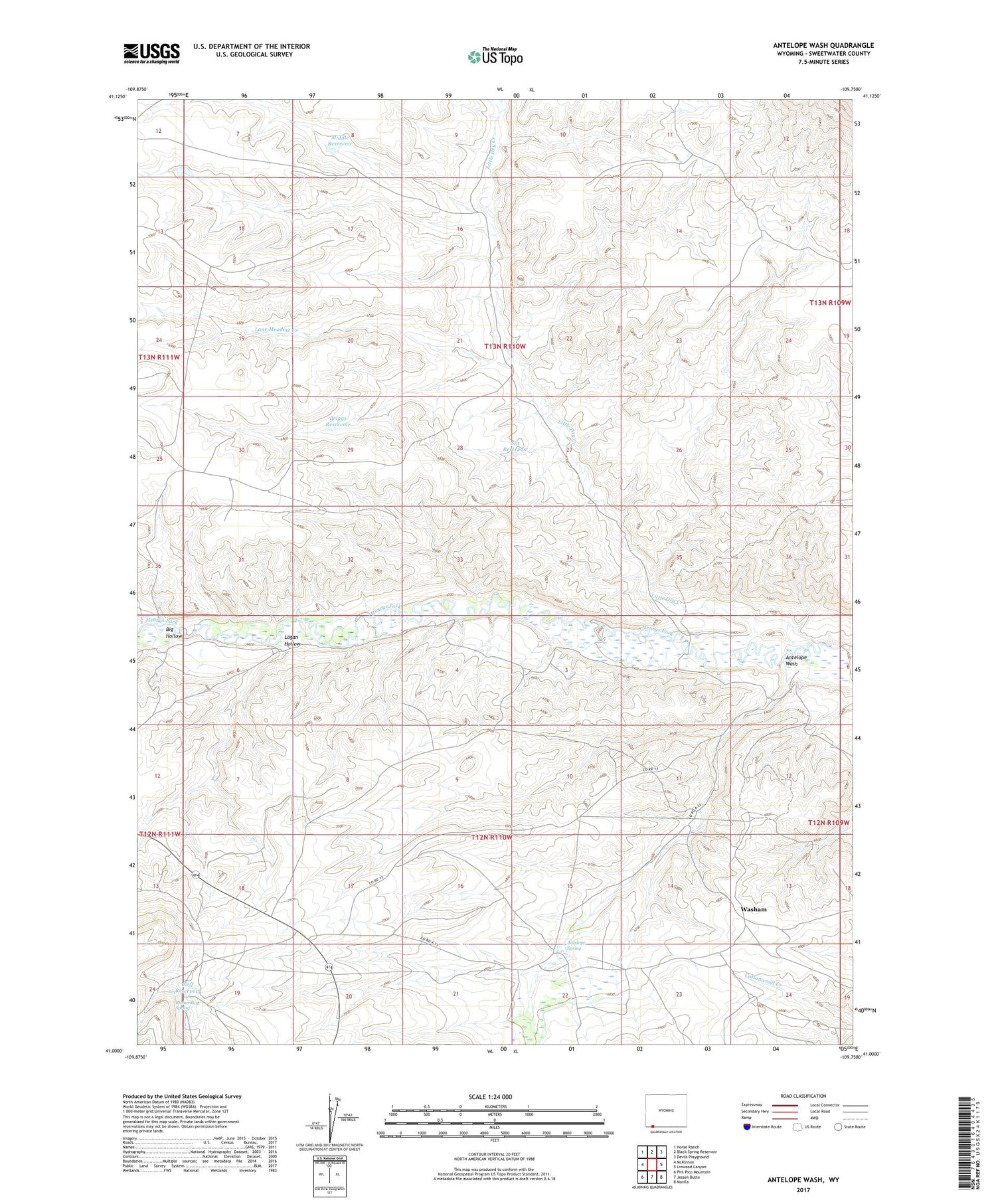
2021 topographic map quadrangle Antelope Wash in the state of Wyoming. Scale: 1:24000. Based on the newly updated USGS 7.5' US Topo map series, this map is in the following counties: Sweetwater. The map contains contour data, water features, and other items you are used to seeing on USGS maps, but also has updated roads and other features. This is the next generation of topographic maps. Printed on high-quality waterproof paper with UV fade-resistant inks.
Quads adjacent to this one:
West: McKinnon
Northwest: Horse Ranch
North: Black Spring Reservoir
Northeast: Devils Playground
East: Linwood Canyon
Southeast: Manila
South: Jessen Butte
Southwest: Phil Pico Mountain
Contains the following named places: Antelope Spring, Antelope Wash, Big Hollow, Briggs Reservoir, Lane Meadow Creek, Little Dry Creek, Logan Hollow, Middle Reservoir, Neff Reservoir, Richardson Spring, Silt Reservoir, Washam


