MyTopo
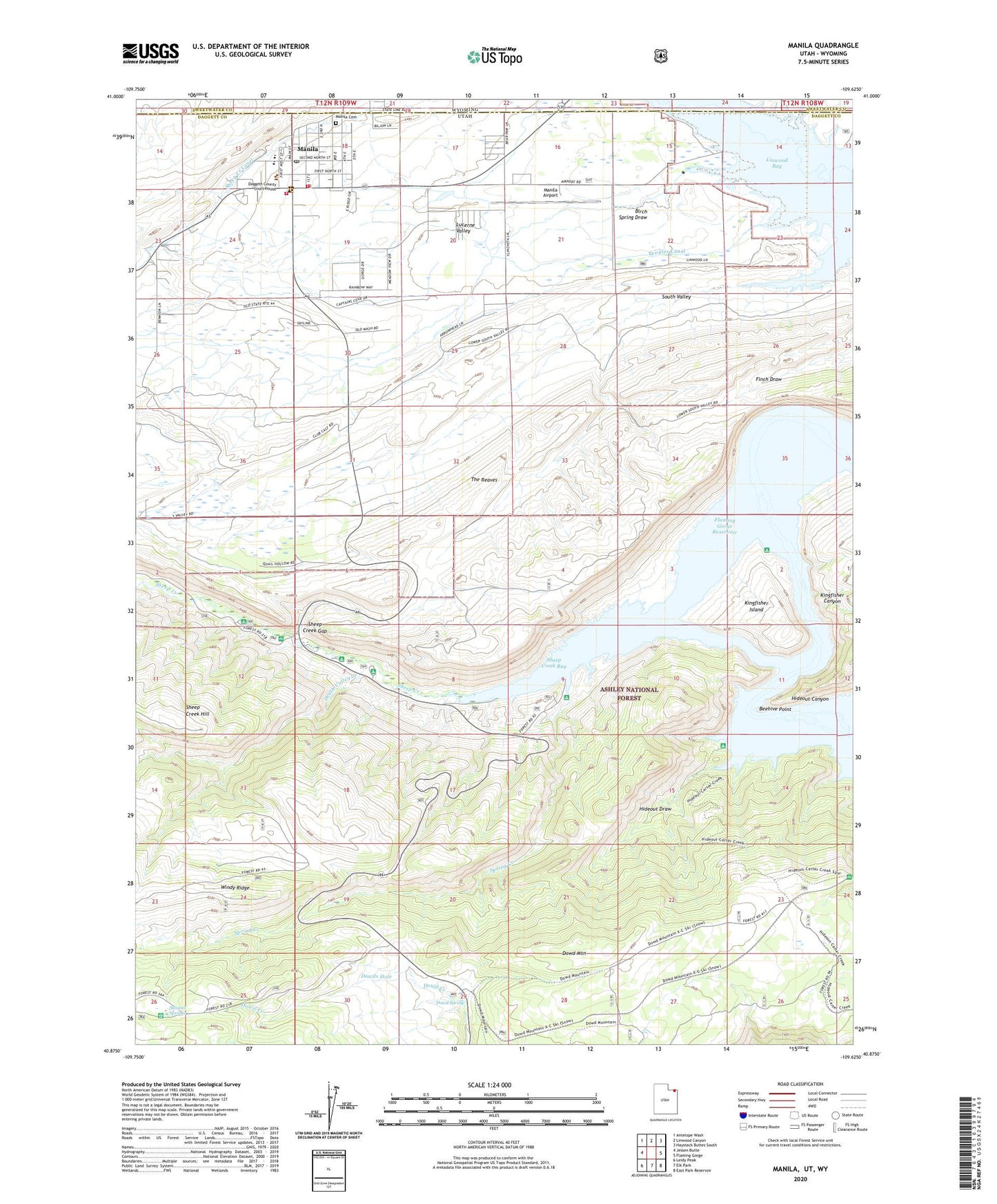
Manila Utah US Topo Map
Couldn't load pickup availability
Also explore the Manila Forest Service Topo of this same quad for updated USFS data
2023 topographic map quadrangle Manila in the states of Utah, Wyoming. Scale: 1:24000. Based on the newly updated USGS 7.5' US Topo map series, this map is in the following counties: Daggett, Sweetwater. The map contains contour data, water features, and other items you are used to seeing on USGS maps, but also has updated roads and other features. This is the next generation of topographic maps. Printed on high-quality waterproof paper with UV fade-resistant inks.
Quads adjacent to this one:
West: Jessen Butte
Northwest: Antelope Wash
North: Linwood Canyon
Northeast: Haystack Buttes South
East: Flaming Gorge
Southeast: East Park Reservoir
South: Elk Park
Southwest: Leidy Peak
Contains the following named places: Beehive Point, Birch Spring Draw, Carmel Campground, Daggett County Ambulance Service, Death Valley Creek, Death Valley Enclosure, Dowd Mountain, Dowd Mountain Enclosure, Dowd Mountain Overlook Picnic Area, Dowd Spring, Dowd Spring Recreation Area, Dowds Hole, Dowds Hole Enclosure, Flamingo Gorge Overlook, Henrys Fork, Hideout Boat Camp, Hideout Canyon Campground, Hideout Draw, Hideout Eagle Basin Trail, Kingfisher Canyon, Kingfisher Creek, Kingfisher Island, Kingfisher Island Campground, Kingfisher Park, Linwood, Manila, Manila Airport, Manila Cemetery, Manila Elementary School, Manila High School, Manila Post Office, Manila Ranger Station, Manila Volunteer Fire Department, Mann Camp, Moenkopi Campground, Navajo Cliffs Picnic Area, Peoples Canal, Sheep Creek, Sheep Creek Bay, Sheep Creek Bay Campground, Sheep Creek Canal, Sheep Creek Gap, South Valley, Spring Creek, Summit Springs, Summit Springs Guard Station, The Church of Jesus Christ of Latter Day Saints, The Reaves, Town of Manila, United States Forest Service Fire Station - Manila Office, West Daggett Division, Willow Camp