MyTopo
Linwood Canyon Wyoming US Topo Map
Couldn't load pickup availability
Also explore the Linwood Canyon Forest Service Topo of this same quad for updated USFS data
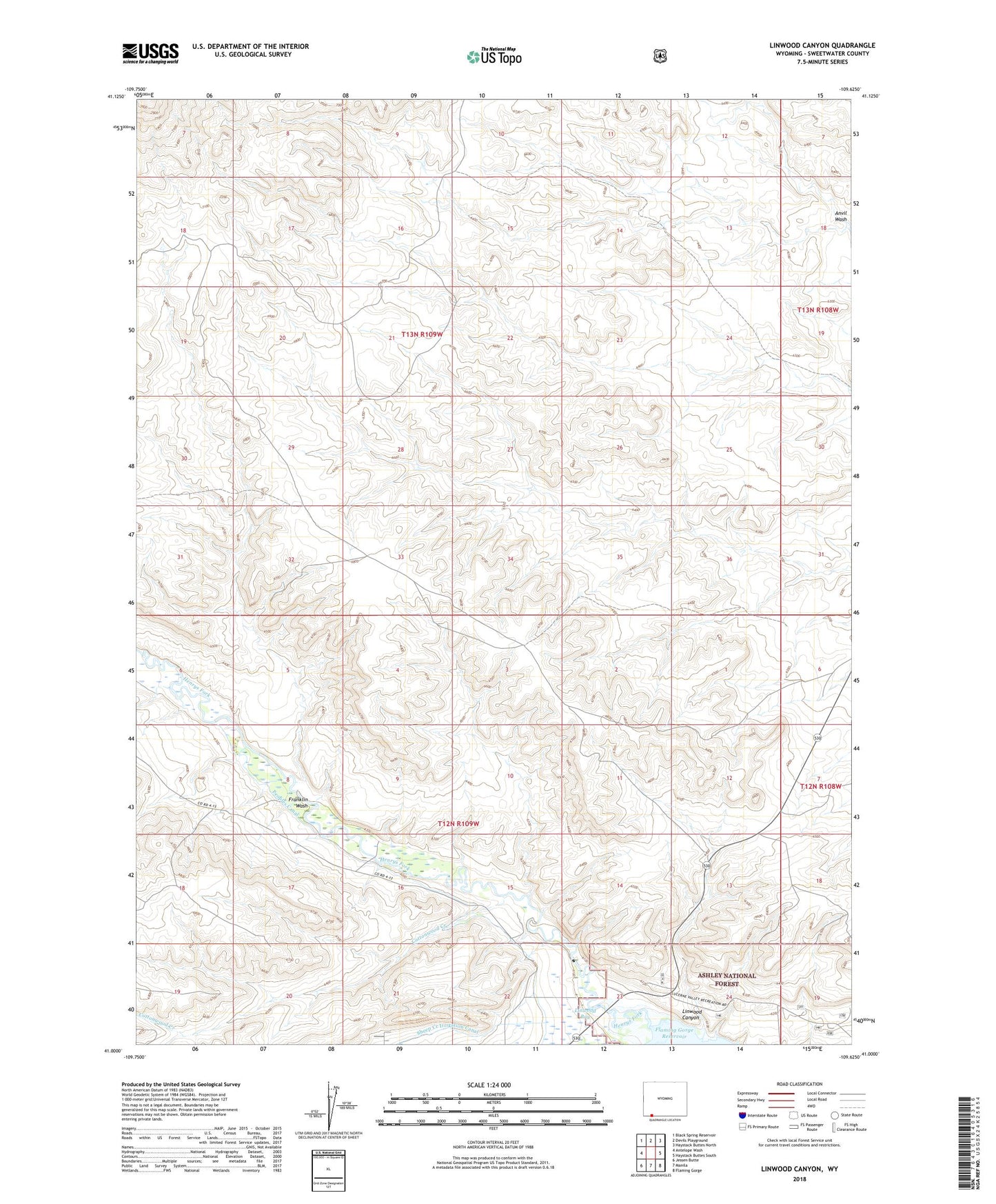
2021 topographic map quadrangle Linwood Canyon in the state of Wyoming. Scale: 1:24000. Based on the newly updated USGS 7.5' US Topo map series, this map is in the following counties: Sweetwater. The map contains contour data, water features, and other items you are used to seeing on USGS maps, but also has updated roads and other features. This is the next generation of topographic maps. Printed on high-quality waterproof paper with UV fade-resistant inks.
Quads adjacent to this one:
West: Antelope Wash
Northwest: Black Spring Reservoir
North: Devils Playground
Northeast: Haystack Buttes North
East: Haystack Buttes South
Southeast: Flaming Gorge
South: Manila
Southwest: Jessen Butte
This map covers the same area as the classic USGS quad with code o41109a6.
Contains the following named places: Cottonwood Creek, Franklin Wash, John Jarvie Mine, Linwood Canyon, Sheep Creek Irrigation Canal, Washam Census Designated Place