MyTopo
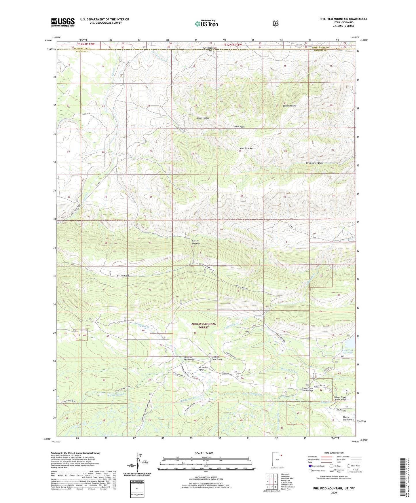
Phil Pico Mountain Utah US Topo Map
Couldn't load pickup availability
Also explore the Phil Pico Mountain Forest Service Topo of this same quad for updated USFS data
2023 topographic map quadrangle Phil Pico Mountain in the state of Utah. Scale: 1:24000. Based on the newly updated USGS 7.5' US Topo map series, this map is in the following counties: Daggett, Sweetwater. The map contains contour data, water features, and other items you are used to seeing on USGS maps, but also has updated roads and other features. This is the next generation of topographic maps. Printed on high-quality waterproof paper with UV fade-resistant inks.
Quads adjacent to this one:
West: Hoop Lake
Northwest: Burntfork
North: McKinnon
Northeast: Antelope Wash
East: Jessen Butte
Southeast: Leidy Peak
South: Whiterocks Lake
Southwest: Chepeta Lake
Contains the following named places: Anson Cabin, Carter Dugway, Corson Peak, Hickerson Park, Hickerson Park Bridge, Lodgepole Canal Bridge, Middle Fork Sheep Creek, North Fork Sheep Creek, Phil Pico Mountain, Sheep Creek Canal Bridge, South Fork Sheep Creek, Upper Sheep Creek Bridge