MyTopo
Bald Mountain Wyoming US Topo Map
Couldn't load pickup availability
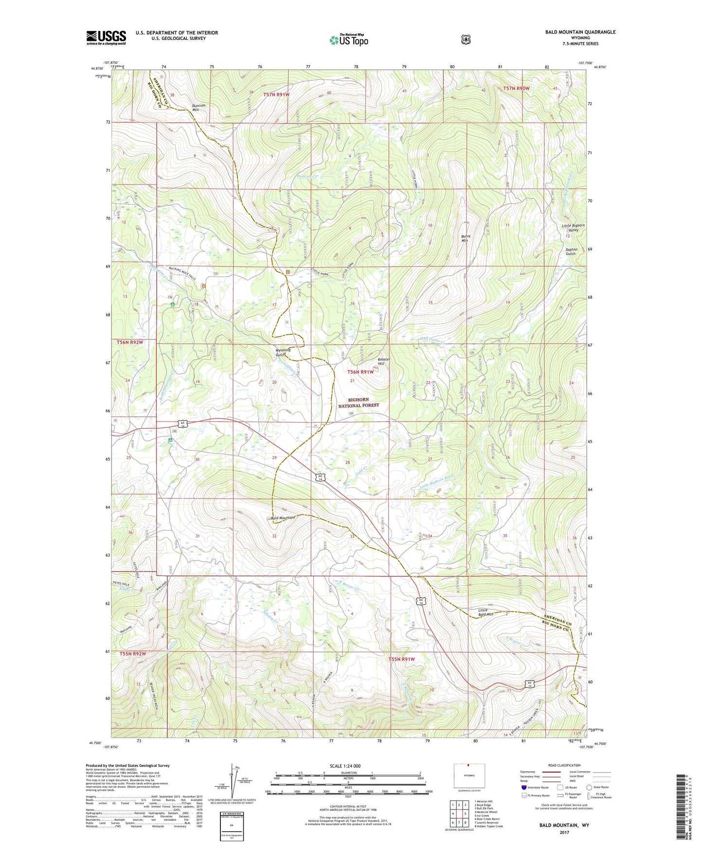
2021 topographic map quadrangle Bald Mountain in the state of Wyoming. Scale: 1:24000. Based on the newly updated USGS 7.5' US Topo map series, this map is in the following counties: Sheridan, Big Horn. The map contains contour data, water features, and other items you are used to seeing on USGS maps, but also has updated roads and other features. This is the next generation of topographic maps. Printed on high-quality waterproof paper with UV fade-resistant inks.
Quads adjacent to this one:
West: Medicine Wheel
Northwest: Mexican Hill
North: Boyd Ridge
Northeast: Bull Elk Park
East: Ice Creek
Southeast: Hidden Tepee Creek
South: Leavitt Reservoir
Southwest: Bear Creek Ranch
Contains the following named places: Bald Mountain, Bald Mountain Campground, Bald Mountain City, Bald Mountain Creek, Bald Mountain Placer Claims, Burnt Mountain, Dayton Gulch, Duncum Mountain, Gold Creek, Half Ounce Creek, Little Bald Mountain, Medicine Wheel Ranger Station, Porcupine Campground, Rooster Hill, Wilcox-People Prospect, Wyoming Gulch