MyTopo
Bear Creek Ranch Wyoming US Topo Map
Couldn't load pickup availability
Also explore the Bear Creek Ranch Forest Service Topo of this same quad for updated USFS data
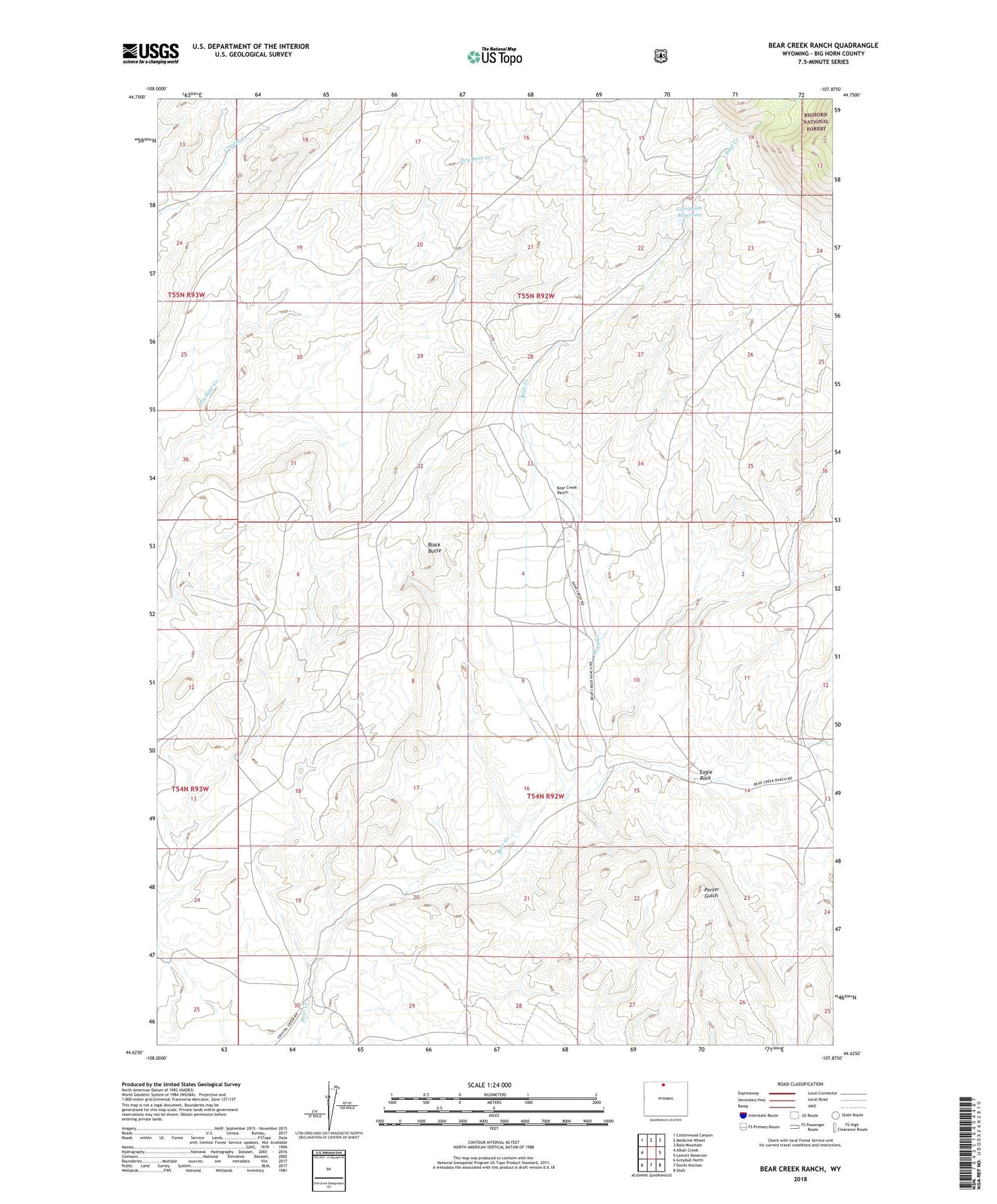
2021 topographic map quadrangle Bear Creek Ranch in the state of Wyoming. Scale: 1:24000. Based on the newly updated USGS 7.5' US Topo map series, this map is in the following counties: Big Horn. The map contains contour data, water features, and other items you are used to seeing on USGS maps, but also has updated roads and other features. This is the next generation of topographic maps. Printed on high-quality waterproof paper with UV fade-resistant inks.
Quads adjacent to this one:
West: Alkali Creek
Northwest: Cottonwood Canyon
North: Medicine Wheel
Northeast: Bald Mountain
East: Leavitt Reservoir
Southeast: Shell
South: Devils Kitchen
Southwest: Greybull North
This map covers the same area as the classic USGS quad with code o44107f8.
Contains the following named places: Bear Creek Ranch, Black Butte, Eagle Rock, End of Day Mine, Flockhart Dam, Flockhart Reservoir, Lampman Reservoir, Sun Up Claim