MyTopo
Medicine Wheel Wyoming US Topo Map
Couldn't load pickup availability
Also explore the Medicine Wheel Forest Service Topo of this same quad for updated USFS data
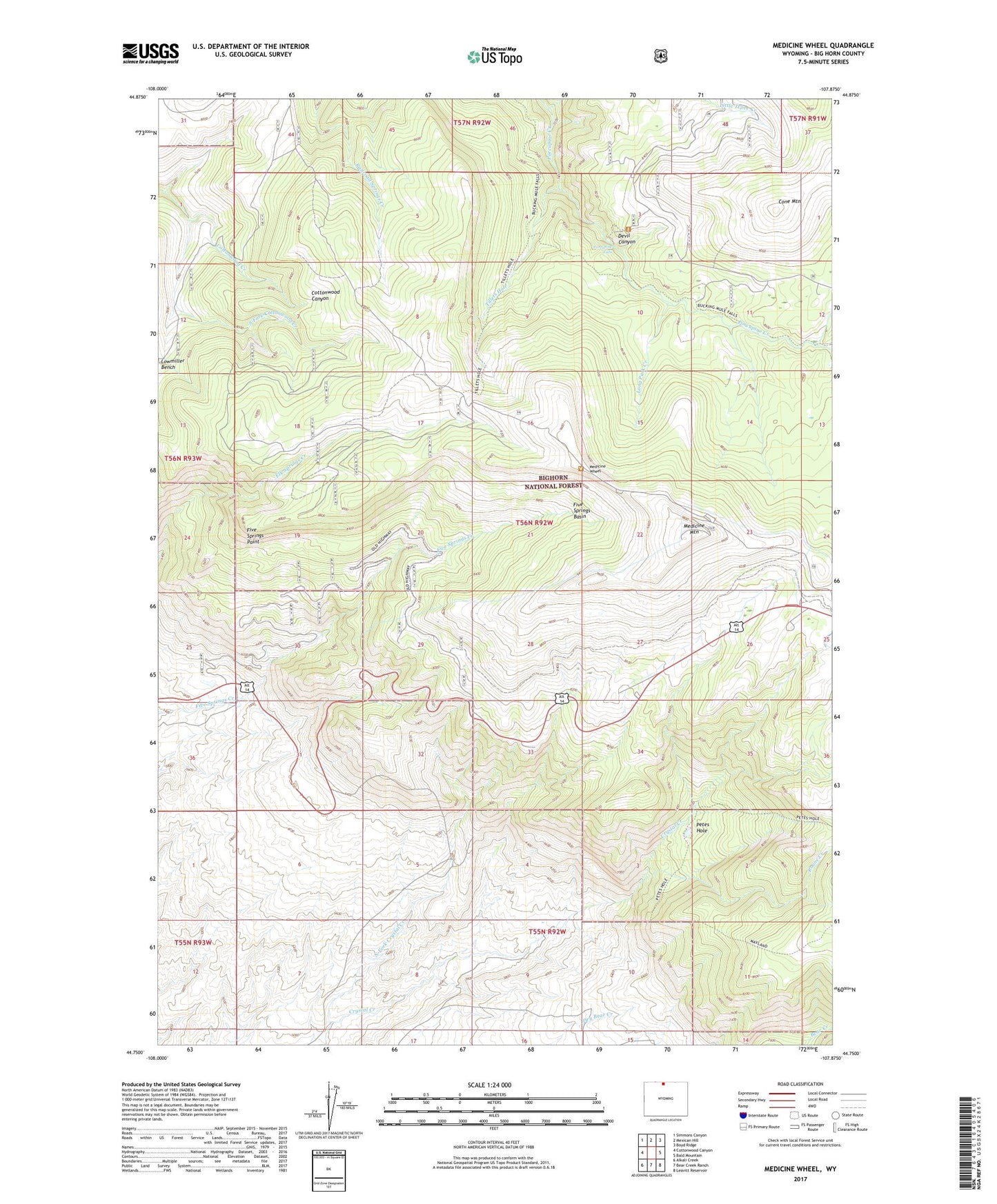
2021 topographic map quadrangle Medicine Wheel in the state of Wyoming. Scale: 1:24000. Based on the newly updated USGS 7.5' US Topo map series, this map is in the following counties: Big Horn. The map contains contour data, water features, and other items you are used to seeing on USGS maps, but also has updated roads and other features. This is the next generation of topographic maps. Printed on high-quality waterproof paper with UV fade-resistant inks.
Quads adjacent to this one:
West: Cottonwood Canyon
Northwest: Simmons Canyon
North: Mexican Hill
Northeast: Boyd Ridge
East: Bald Mountain
Southeast: Leavitt Reservoir
South: Bear Creek Ranch
Southwest: Alkali Creek
This map covers the same area as the classic USGS quad with code o44107g8.
Contains the following named places: Cone Mountain, Crystal Lake, Crystal Lake Dam, Five Springs Area Mine, Five Springs Basin, Five Springs Campground, Five Springs Point, Hidden Basin Picnic Area, KZMQ-FM (Greybull), Little Tepee Creek, Long Park Creek, Medicine Mountain, Medicine Wheel, N and S Dam, N and S Reservoir, North Fork Crystal Creek, Petes Hole, Porcupine Falls, Roane Creek, South Fork Cottonwood Creek, Tillets Hole