MyTopo
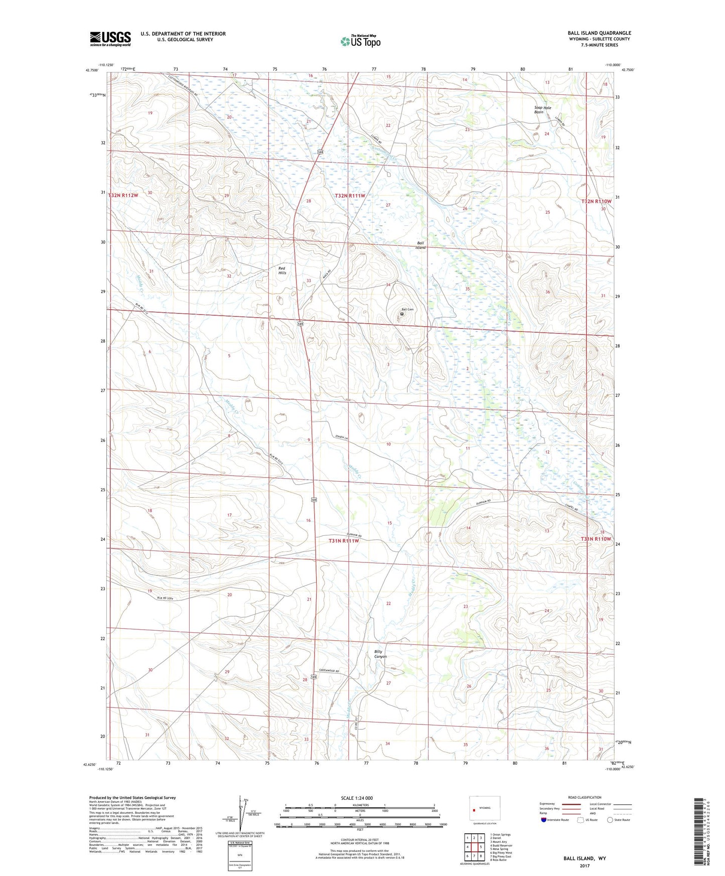
Ball Island Wyoming US Topo Map
Couldn't load pickup availability
2021 topographic map quadrangle Ball Island in the state of Wyoming. Scale: 1:24000. Based on the newly updated USGS 7.5' US Topo map series, this map is in the following counties: Sublette. The map contains contour data, water features, and other items you are used to seeing on USGS maps, but also has updated roads and other features. This is the next generation of topographic maps. Printed on high-quality waterproof paper with UV fade-resistant inks.
Quads adjacent to this one:
West: Budd Reservoir
Northwest: Onion Springs
North: Daniel
Northeast: Mount Airy
East: Mesa Spring
Southeast: Ross Butte
South: Big Piney East
Southwest: Big Piney West
This map covers the same area as the classic USGS quad with code o42110f1.
Contains the following named places: Ardie Ditch, Ball Cemetery, Ball Island, Beta Ditch, Billy Canyon, Billy Canyon Reservoir Number 1, Bryan Ditch, Cottonwood Canal, Green River Supply Canal Lateral Number 1, Jigger Ditch, King Ditch, Park Ditch Number 1, Ranchero Ditch, Red Hills, Shafer Ditch, Smith Ditch, Valley Ditch, W L Smith Ditch