MyTopo
Onion Springs Wyoming US Topo Map
Couldn't load pickup availability
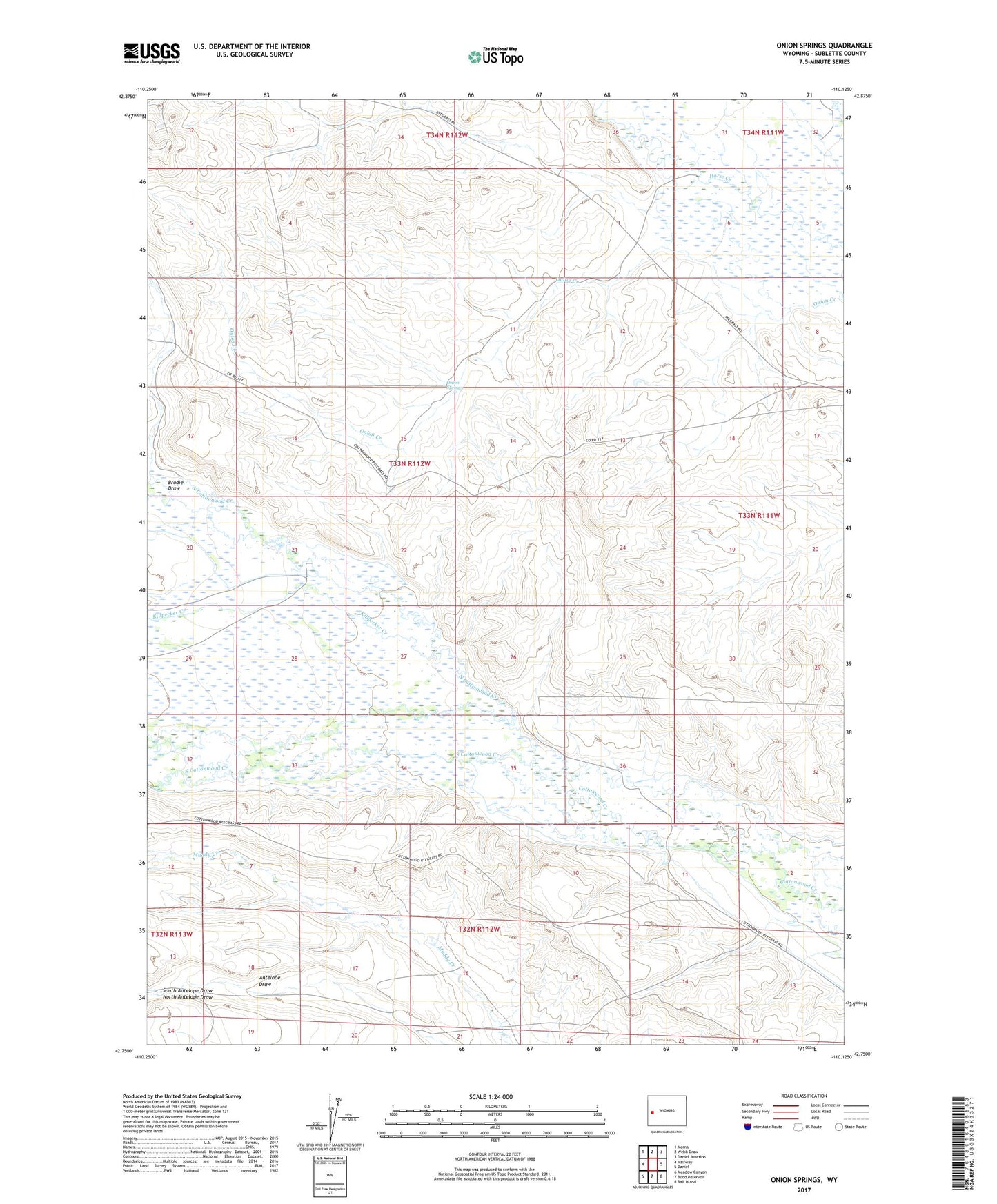
2021 topographic map quadrangle Onion Springs in the state of Wyoming. Scale: 1:24000. Based on the newly updated USGS 7.5' US Topo map series, this map is in the following counties: Sublette. The map contains contour data, water features, and other items you are used to seeing on USGS maps, but also has updated roads and other features. This is the next generation of topographic maps. Printed on high-quality waterproof paper with UV fade-resistant inks.
Quads adjacent to this one:
West: Halfway
Northwest: Merna
North: Webb Draw
Northeast: Daniel Junction
East: Daniel
Southeast: Ball Island
South: Budd Reservoir
Southwest: Meadow Canyon
This map covers the same area as the classic USGS quad with code o42110g2.
Contains the following named places: Brodie Draw, Coyote Reservoir, Elaines Detention Reservoir, Hope Ditch, Jewett Allot Well, Jewett Red Flat Reservoir, Killpecker Creek, Last Chance Ditch, Lindback Ditch, North Antelope Draw, North Cottonwood Creek, Onion Springs, Round Valley Well, South Antelope Draw, South Cottonwood Creek