
MyTopo
Banner Mountain Wyoming US Topo Map
Couldn't load pickup availability
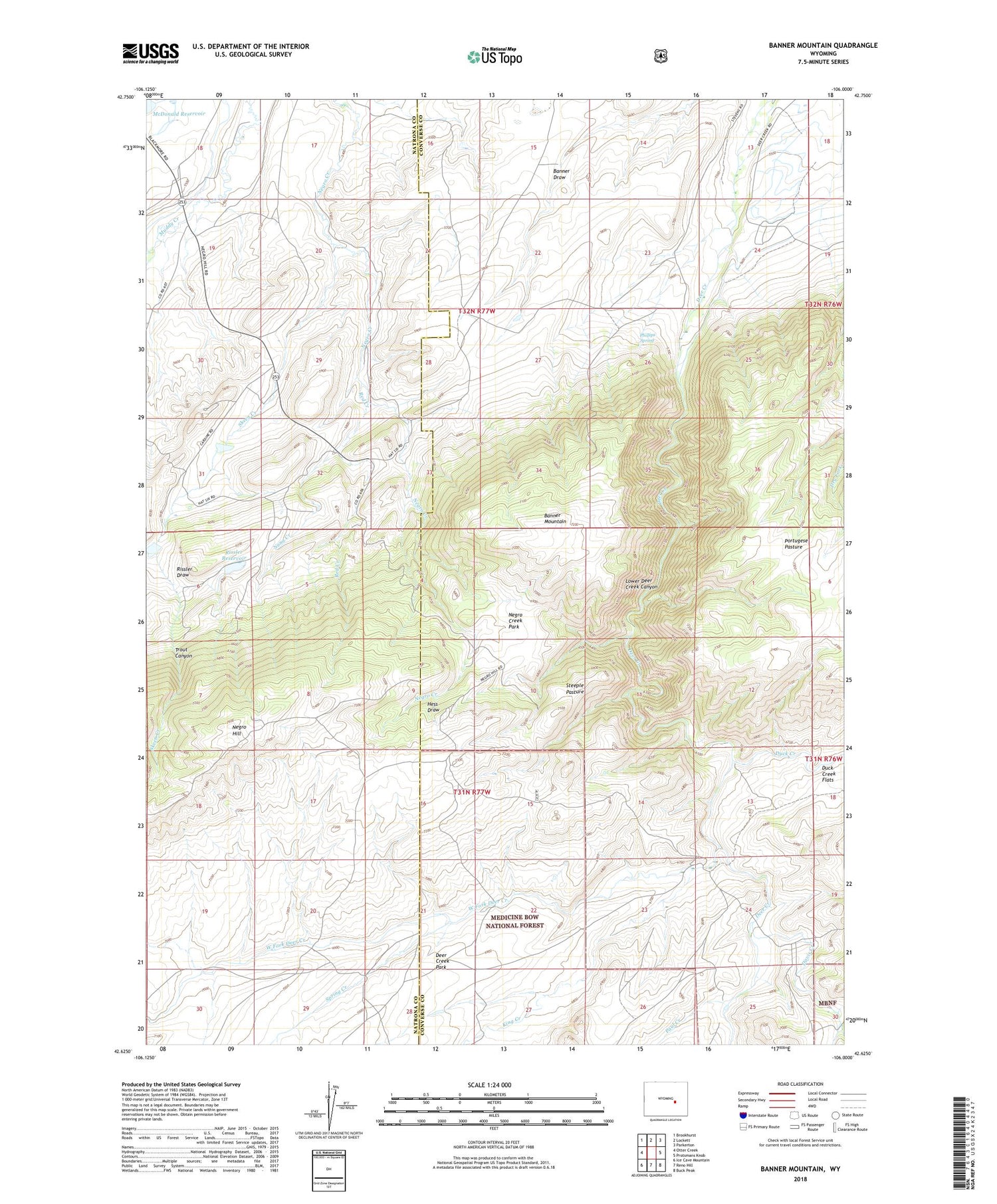
2021 topographic map quadrangle Banner Mountain in the state of Wyoming. Scale: 1:24000. Based on the newly updated USGS 7.5' US Topo map series, this map is in the following counties: Converse, Natrona. The map contains contour data, water features, and other items you are used to seeing on USGS maps, but also has updated roads and other features. This is the next generation of topographic maps. Printed on high-quality waterproof paper with UV fade-resistant inks.
Quads adjacent to this one:
West: Otter Creek
Northwest: Brookhurst
North: Lockett
Northeast: Parkerton
East: Protsmans Knob
Southeast: Buck Peak
South: Reno Hill
Southwest: Ice Cave Mountain
Contains the following named places: Agnes Dam, Agnes Reservoir, Banner Mountain, Banner Ranch, Beaver Creek, Brooks Camp, Cardine-Keith Dam, Cardine-Keith Reservoir, Davis Creek, Davis Ranch, Deer Creek Canyon Chromite Mine, Deer Creek Park, Duck Creek, Hess Draw, Keith Ranch, Kimball Ranch, King Creek, Koch Deposit, Koch Deposit Number One, Lamb Upper Dam, Lamb Upper Reservoir, Lower Deer Creek Canyon, Negro Creek Park, Nona Creek, Paul Creek, Phillips Spring, Portugese Pasture, Red Creek, Rissler Dam, Rissler Draw, Rissler Ranch, Rissler Reservoir, Silver State Ditch Number 1, Skeen Creek, Smith Creek, Smith Ranch, Spring Creek, Steeple Pasture, Trout Canyon, V R Camp, V R Ditch, West Fork Deer Creek


