MyTopo
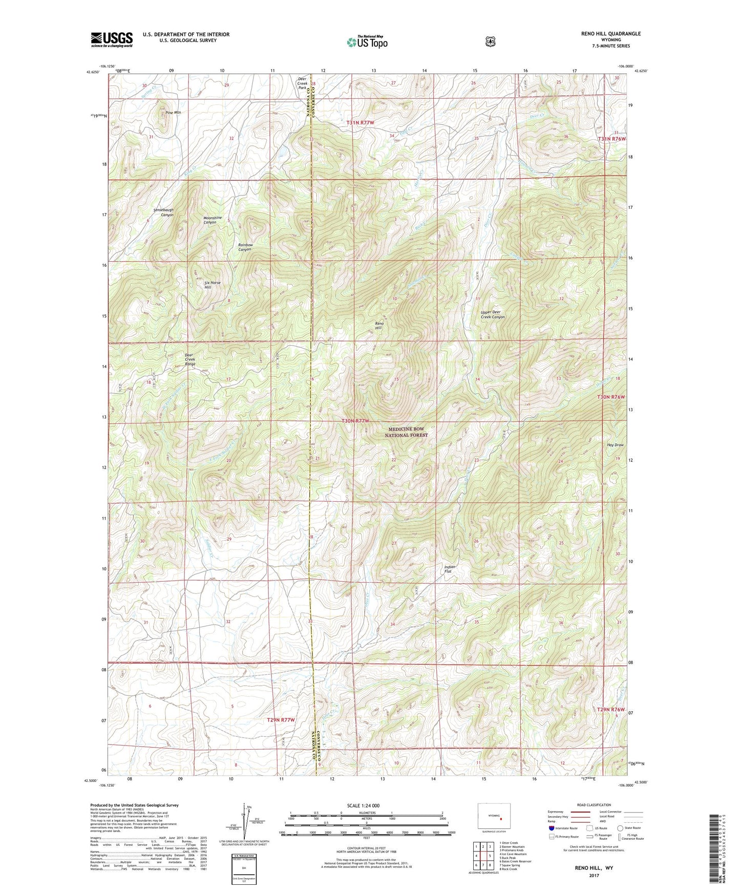
Reno Hill Wyoming US Topo Map
Couldn't load pickup availability
Also explore the Reno Hill Forest Service Topo of this same quad for updated USFS data
2021 topographic map quadrangle Reno Hill in the state of Wyoming. Scale: 1:24000. Based on the newly updated USGS 7.5' US Topo map series, this map is in the following counties: Converse, Natrona. The map contains contour data, water features, and other items you are used to seeing on USGS maps, but also has updated roads and other features. This is the next generation of topographic maps. Printed on high-quality waterproof paper with UV fade-resistant inks.
Quads adjacent to this one:
West: Ice Cave Mountain
Northwest: Otter Creek
North: Banner Mountain
Northeast: Protsmans Knob
East: Buck Peak
Southeast: Rock Creek
South: Squaw Spring
Southwest: Bates Creek Reservoir
This map covers the same area as the classic USGS quad with code o42106e1.
Contains the following named places: Barker Sheep Camp, Buck Creek, Canyon Creek, East Fork Soldier Creek, Harris Creek, Horse Creek, Howard Creek, Indian Flat, Moonshine Canyon, Old Tobin Place, Pine Mountain, Rainbow Canyon, Reno Hill, Sawmill Creek, Sensebaugh Canyon, Six Horse Hill, Soldier Creek, Stewart Ranch, Upper Deer Creek Canyon, West Fork, West Fork Soldier Creek