MyTopo
Bear Creek Wyoming US Topo Map
Couldn't load pickup availability
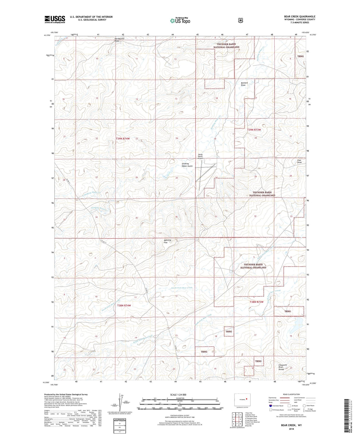
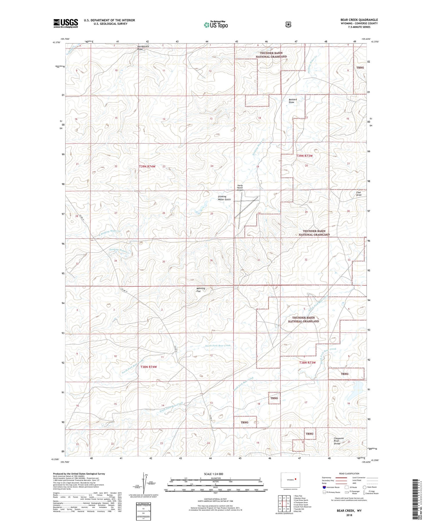
2021 topographic map quadrangle Bear Creek in the state of Wyoming. Scale: 1:24000. Based on the newly updated USGS 7.5' US Topo map series, this map is in the following counties: Converse. The map contains contour data, water features, and other items you are used to seeing on USGS maps, but also has updated roads and other features. This is the next generation of topographic maps. Printed on high-quality waterproof paper with UV fade-resistant inks.
Quads adjacent to this one:
West: Thompson Draw
Northwest: Ross Flat
North: Macken Draw
Northeast: Coal Draw North
East: Coal Draw South
Southeast: Red Hill
South: Suicide Hill
Southwest: South Fork Reservoir
Contains the following named places: Bustard Draw, Hardy Number 1 Dam, Hardy Number 1 Reservoir, Hardy Ranch, Hardy Ranch Airport, Hornbuckle Draw, Manning Flat, Manning Ranch, North Stinking Water Creek, Seepage Control Dam, Seepage Control Reservoir, Stinking Water Gulch, Tailings Disposal Dam, Tailings Disposal Reservoir