MyTopo
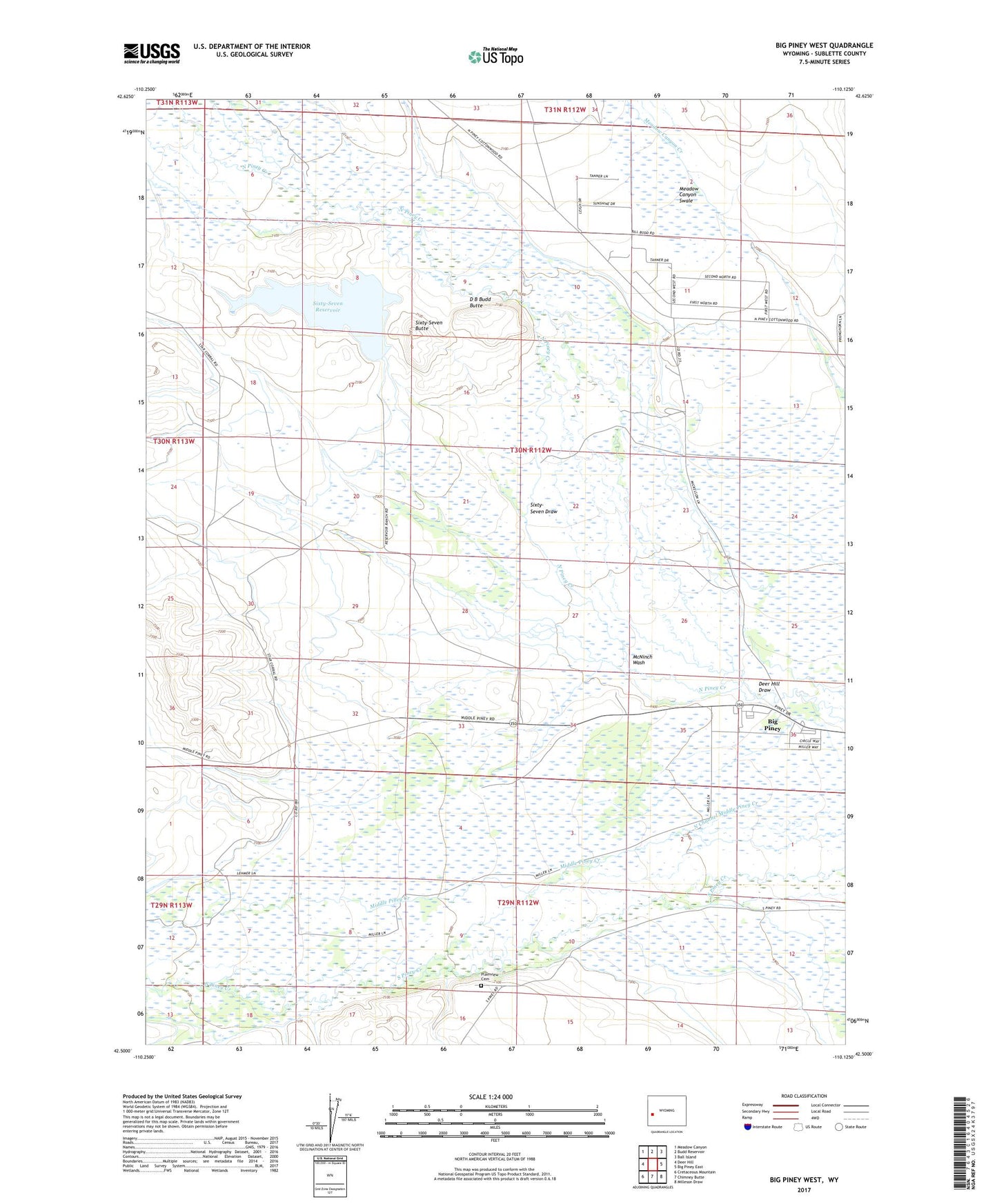
Big Piney West Wyoming US Topo Map
Couldn't load pickup availability
2021 topographic map quadrangle Big Piney West in the state of Wyoming. Scale: 1:24000. Based on the newly updated USGS 7.5' US Topo map series, this map is in the following counties: Sublette. The map contains contour data, water features, and other items you are used to seeing on USGS maps, but also has updated roads and other features. This is the next generation of topographic maps. Printed on high-quality waterproof paper with UV fade-resistant inks.
Quads adjacent to this one:
West: Deer Hill
Northwest: Meadow Canyon
North: Budd Reservoir
Northeast: Ball Island
East: Big Piney East
Southeast: Milleson Draw
South: Chimney Butte
Southwest: Cretaceous Mountain
Contains the following named places: Abo Ditch, D B Budd Butte, Deer Hill Draw, East Channel, East Star Corral Oil Field, H McKay Ditch, Holden Ditch, Homer Ditch Number 1, Homestake Ditch, Lehmer Ditch, McNinch Ditch, McNinch Wash, Meadow Canyon Swale, Osterhout Edwards Ditch, Plainview Cemetery, Reardon Ditch, Sixty-Seven Butte, Sixty-Seven Draw, Sixty-Seven Reservoir, Sixty-Seven Reservoir Dam, Sixty-Seven Reservoir Distribution Canal, South McKay Ditch Number 2, South Piney Ditch, Spring Creek, Summit Ditch, Tarter Ditch, West Channel, Wilson Ditch, Yankee Ditch