MyTopo
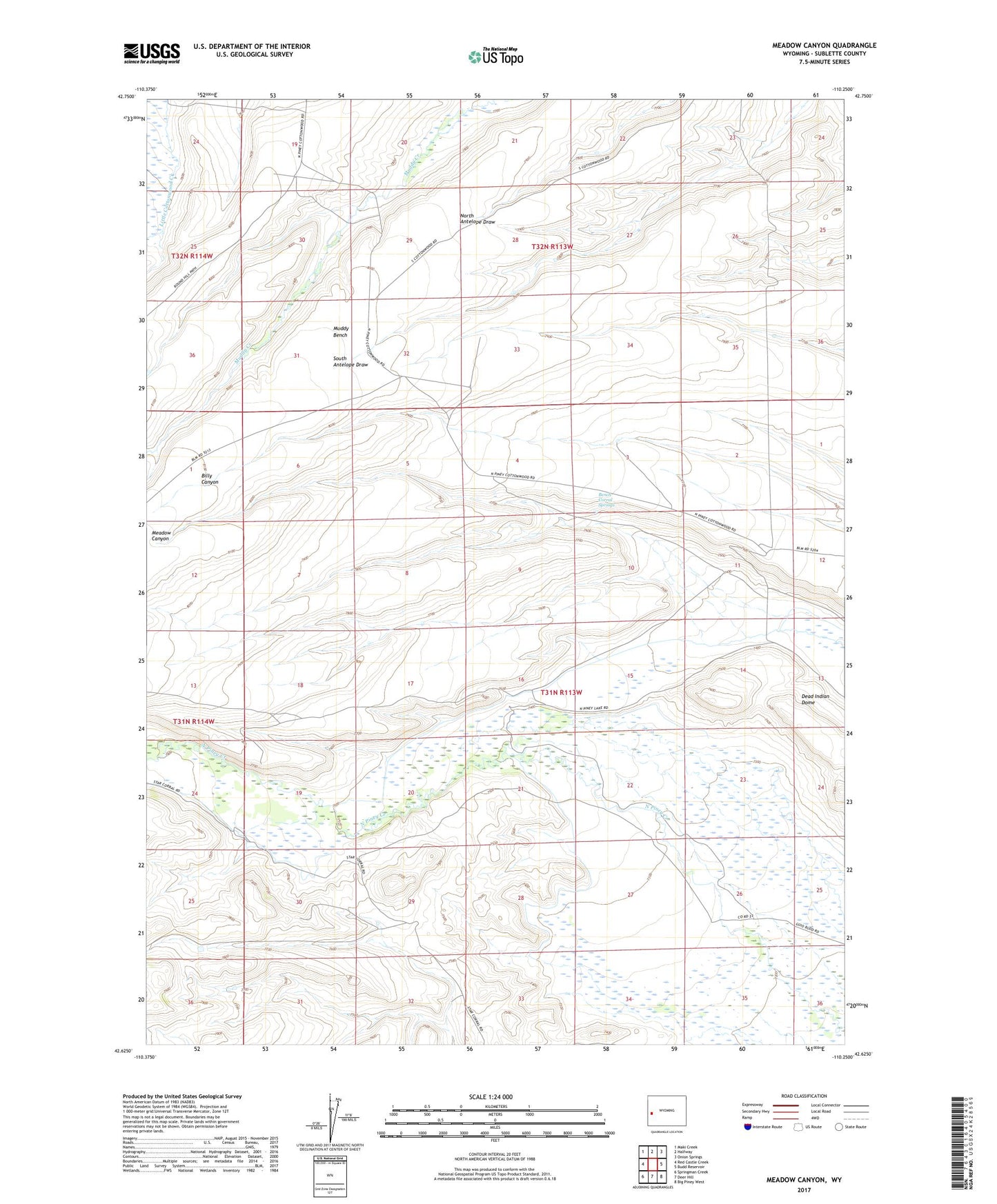
Meadow Canyon Wyoming US Topo Map
Couldn't load pickup availability
2021 topographic map quadrangle Meadow Canyon in the state of Wyoming. Scale: 1:24000. Based on the newly updated USGS 7.5' US Topo map series, this map is in the following counties: Sublette. The map contains contour data, water features, and other items you are used to seeing on USGS maps, but also has updated roads and other features. This is the next generation of topographic maps. Printed on high-quality waterproof paper with UV fade-resistant inks.
Quads adjacent to this one:
West: Red Castle Creek
Northwest: Maki Creek
North: Halfway
Northeast: Onion Springs
East: Budd Reservoir
Southeast: Big Piney West
South: Deer Hill
Southwest: Springman Creek
This map covers the same area as the classic USGS quad with code o42110f3.
Contains the following named places: Bench Corral, Bench Corral Springs, Bluff Ditch, Dead Indian Dome, Dewey Ditch, Gilbert Warren Ditch, Meadow Canyon Ditch, Muddy Bench, North Piney Canal, South Muddy Creek