MyTopo
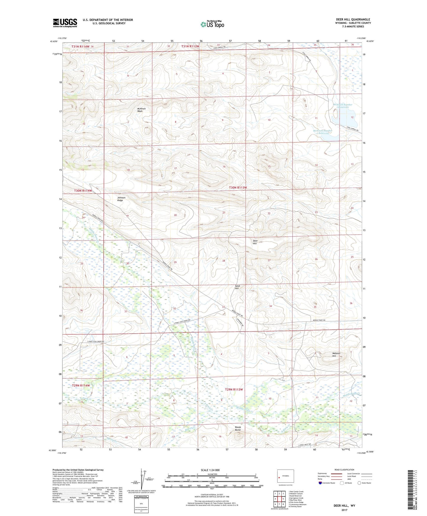
Deer Hill Wyoming US Topo Map
Couldn't load pickup availability
2021 topographic map quadrangle Deer Hill in the state of Wyoming. Scale: 1:24000. Based on the newly updated USGS 7.5' US Topo map series, this map is in the following counties: Sublette. The map contains contour data, water features, and other items you are used to seeing on USGS maps, but also has updated roads and other features. This is the next generation of topographic maps. Printed on high-quality waterproof paper with UV fade-resistant inks.
Quads adjacent to this one:
West: Springman Creek
Northwest: Red Castle Creek
North: Meadow Canyon
Northeast: Budd Reservoir
East: Big Piney West
Southeast: Chimney Butte
South: Cretaceous Mountain
Southwest: Pine Grove Ridge
This map covers the same area as the classic USGS quad with code o42110e3.
Contains the following named places: Beaver Creek, Beaver Ditch, Big Piney Division, Budd Extension, Deer Hill, Ex Pence Ditch, Max Ditch, McNinch Number 1 Reservoir, McNinch Number 2 Reservoir, McNinch Reservoir Number 1 Dam, McNinch Reservoir Number 2 Dam, McNinch Supply Ditch, Rands Butte, Redan Ditch Second Enlargement, Ruben Oil Field, Sand Hill, Sphaeralcea Dam, Sphaeralcea Reservoir, Spring Creek, Spring Ditch, Thompson Ditch, Webster Hill, ZIP Code: 83113