MyTopo
Big Trails Wyoming US Topo Map
Couldn't load pickup availability
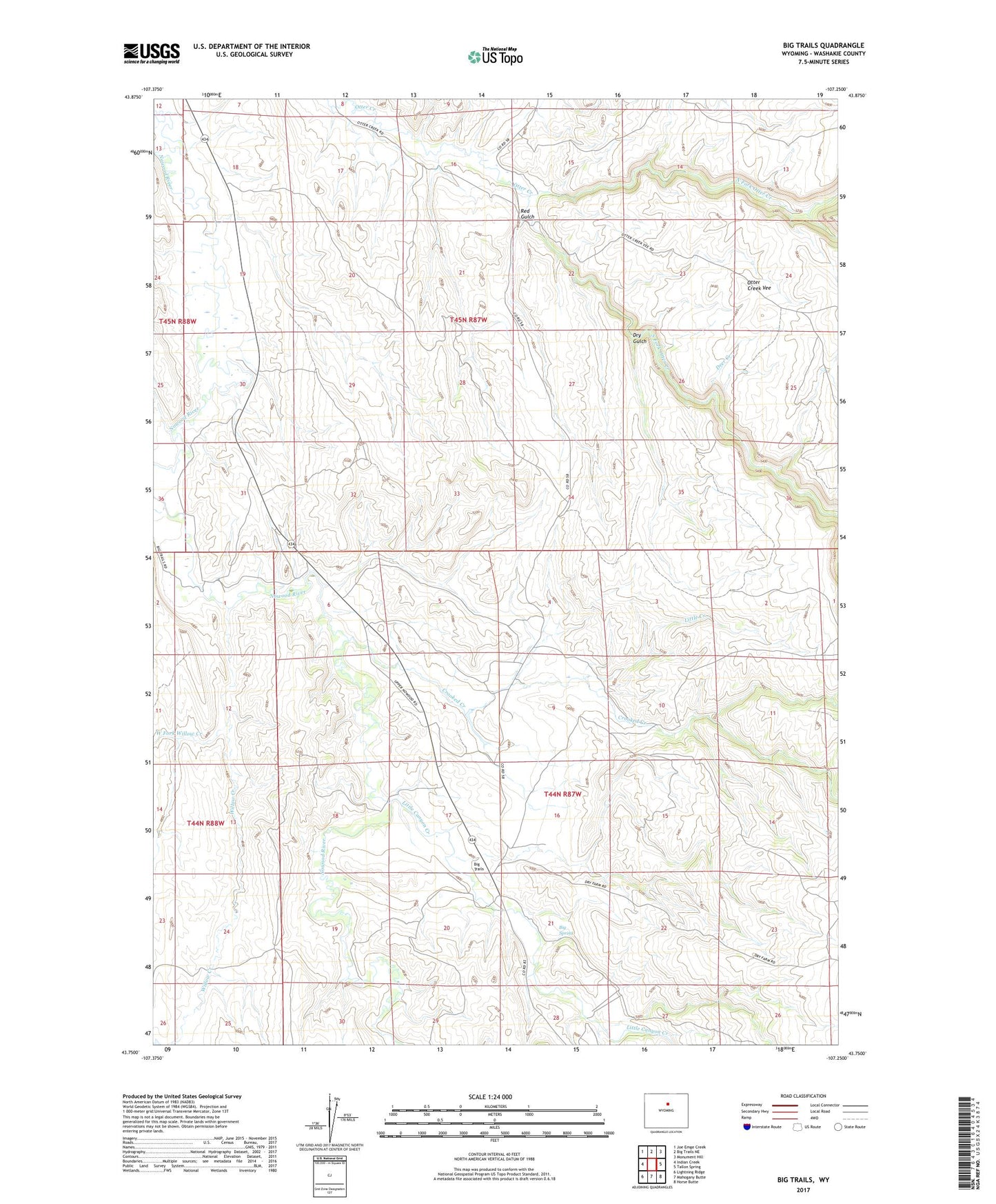
2021 topographic map quadrangle Big Trails in the state of Wyoming. Scale: 1:24000. Based on the newly updated USGS 7.5' US Topo map series, this map is in the following counties: Washakie. The map contains contour data, water features, and other items you are used to seeing on USGS maps, but also has updated roads and other features. This is the next generation of topographic maps. Printed on high-quality waterproof paper with UV fade-resistant inks.
Quads adjacent to this one:
West: Indian Creek
Northwest: Joe Emge Creek
North: Big Trails NE
Northeast: Monument Hill
East: Tallon Spring
Southeast: Horse Butte
South: Mahogany Butte
Southwest: Lightning Ridge
This map covers the same area as the classic USGS quad with code o43107g3.
Contains the following named places: Big Spring, Big Trails, Big Trails Church, Buffalo Creek, Crooked Creek, Deer Creek, Dry Fork Otter Creek, Dry Gulch, Little Canyon Creek, Little Creek, Need Water Reservoir, North Fork Otter Creek, Otter Creek Ranch Airport, Red Gulch, Rimrock Draw, South Fork Otter Creek, Star Pit, Ten Sleep Division, West Fork Willow Creek, Willow Creek