MyTopo
Blacktail Deer Creek Wyoming US Topo Map
Couldn't load pickup availability
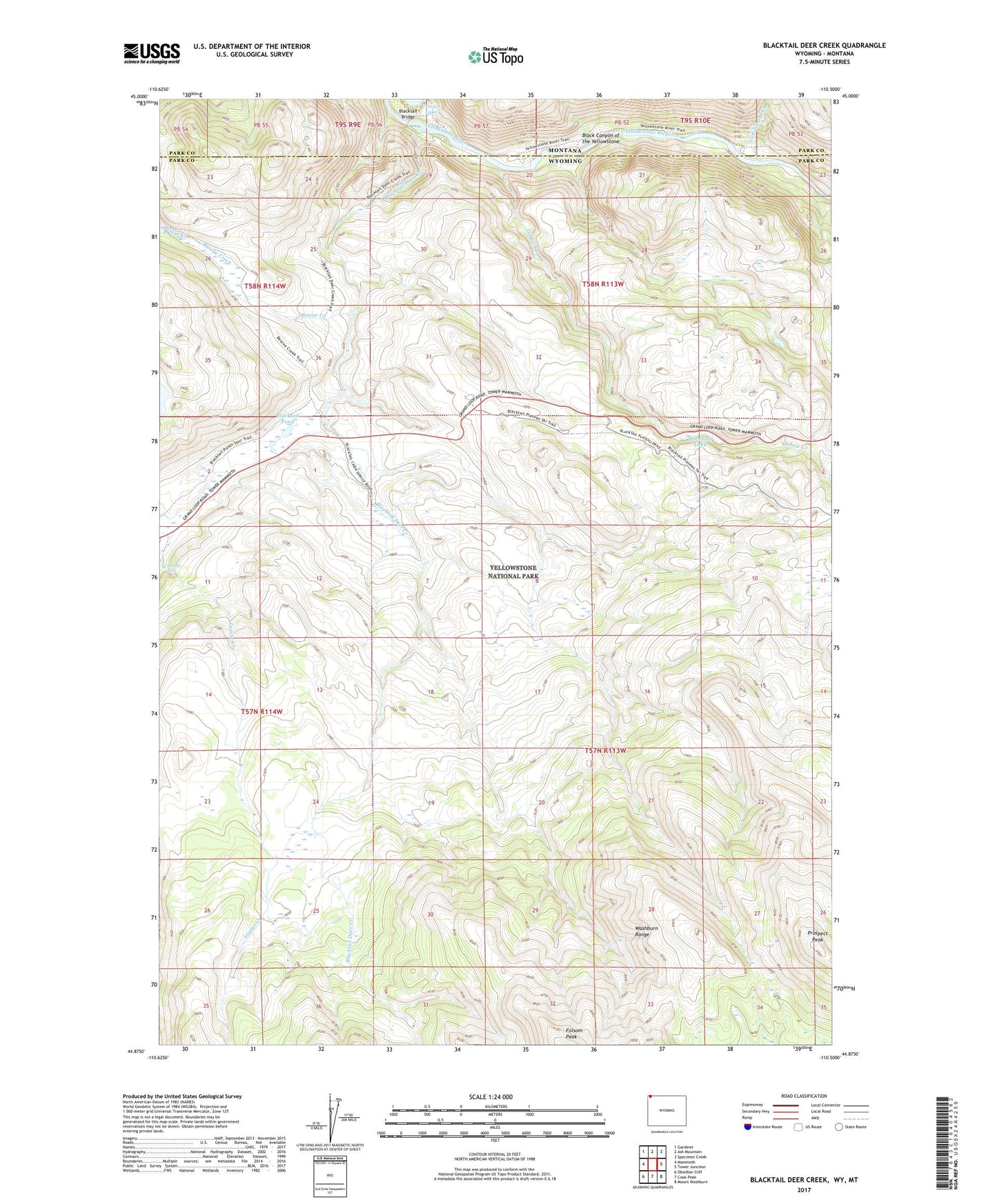
2021 topographic map quadrangle Blacktail Deer Creek in the states of Wyoming, Montana. Scale: 1:24000. Based on the newly updated USGS 7.5' US Topo map series, this map is in the following counties: Park. The map contains contour data, water features, and other items you are used to seeing on USGS maps, but also has updated roads and other features. This is the next generation of topographic maps. Printed on high-quality waterproof paper with UV fade-resistant inks.
Quads adjacent to this one:
West: Mammoth
Northwest: Gardiner
North: Ash Mountain
Northeast: Specimen Creek
East: Tower Junction
Southeast: Mount Washburn
South: Cook Peak
Southwest: Obsidian Cliff
Contains the following named places: Blacktail Bridge, Blacktail Deer Creek, Blacktail Deer Plateau, Blacktail Pond, Cottonwood Creek, Lower Blacktail Trail, Oxbow Creek, Phantom Lake, Prospect Peak, Rescue Creek, Rescue Creek Trail, Wraith Falls