MyTopo
Obsidian Cliff Wyoming US Topo Map
Couldn't load pickup availability
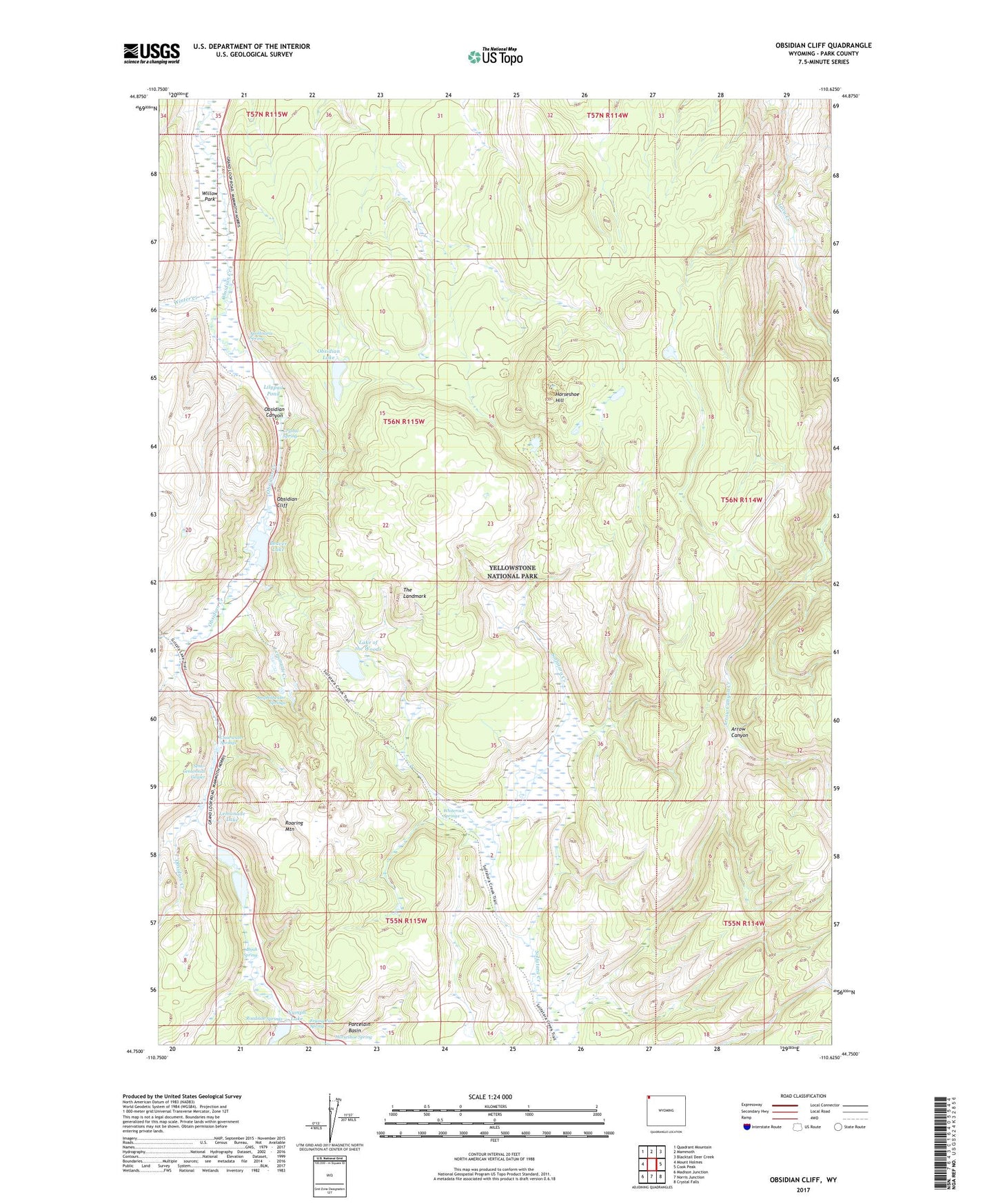
2021 topographic map quadrangle Obsidian Cliff in the state of Wyoming. Scale: 1:24000. Based on the newly updated USGS 7.5' US Topo map series, this map is in the following counties: Park. The map contains contour data, water features, and other items you are used to seeing on USGS maps, but also has updated roads and other features. This is the next generation of topographic maps. Printed on high-quality waterproof paper with UV fade-resistant inks.
Quads adjacent to this one:
West: Mount Holmes
Northwest: Quadrant Mountain
North: Mammoth
Northeast: Blacktail Deer Creek
East: Cook Peak
Southeast: Crystal Falls
South: Norris Junction
Southwest: Madison Junction
This map covers the same area as the classic USGS quad with code o44110g6.
Contains the following named places: Amphitheater Springs, Apollinaris Spring, Beaver Lake, Bijah Spring, Clearwater Springs, Crystal Spring, Frying Pan Spring, Horseshoe Hill, Horseshoe Spring, Lake of the Woods, Lemonade Creek, Lemonade Lake, Lilypad Pond, Nymph Lake, Obsidian Canyon, Obsidian Cliff, Obsidian Lake, Porcelain Basin, Roadside Springs, Roaring Mountain, Semi-Centennial Geyser, The Landmark, Twin Lakes, Whiterock Springs, Willow Park, Winter Creek