MyTopo
Cook Peak Wyoming US Topo Map
Couldn't load pickup availability
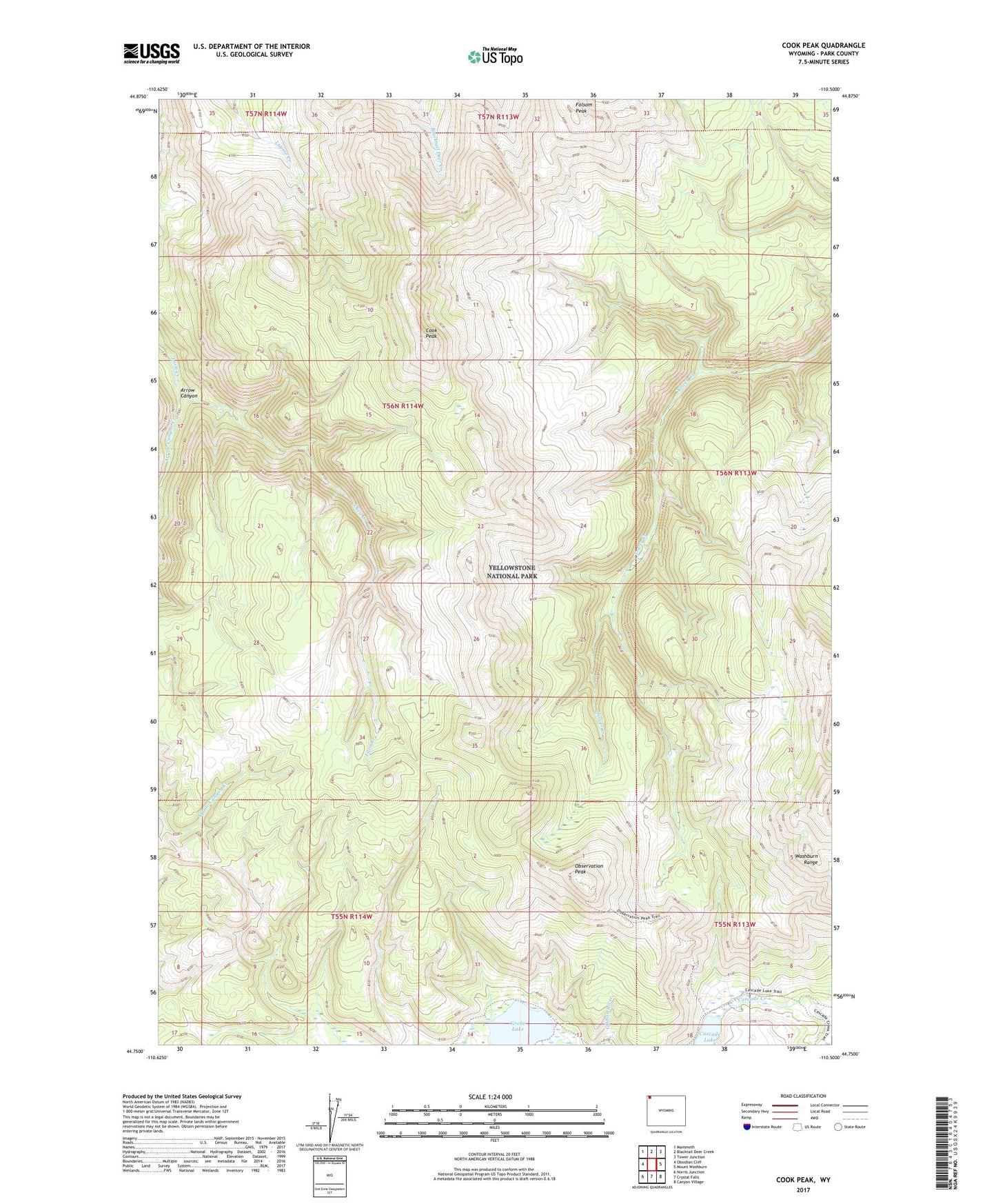
2021 topographic map quadrangle Cook Peak in the state of Wyoming. Scale: 1:24000. Based on the newly updated USGS 7.5' US Topo map series, this map is in the following counties: Park. The map contains contour data, water features, and other items you are used to seeing on USGS maps, but also has updated roads and other features. This is the next generation of topographic maps. Printed on high-quality waterproof paper with UV fade-resistant inks.
Quads adjacent to this one:
West: Obsidian Cliff
Northwest: Mammoth
North: Blacktail Deer Creek
Northeast: Tower Junction
East: Mount Washburn
Southeast: Canyon Village
South: Crystal Falls
Southwest: Norris Junction
This map covers the same area as the classic USGS quad with code o44110g5.
Contains the following named places: Arrow Canyon, Arrow Canyon Creek, Cascade Lake, Cook Peak, Folsom Peak, Grebe Lake, Observation Peak, Washburn Range