MyTopo
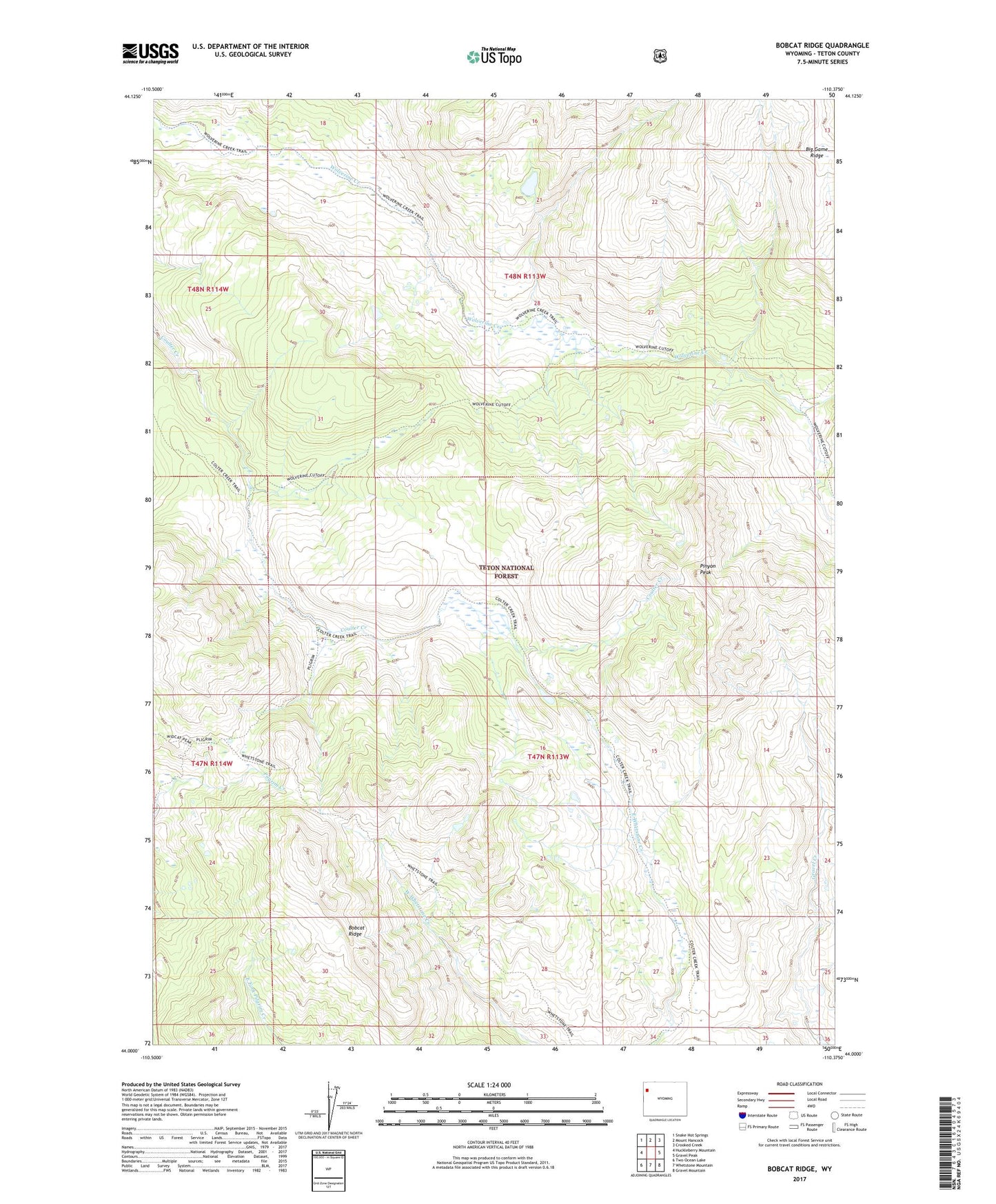
Bobcat Ridge Wyoming US Topo Map
Couldn't load pickup availability
Also explore the Bobcat Ridge Forest Service Topo of this same quad for updated USFS data
2021 topographic map quadrangle Bobcat Ridge in the state of Wyoming. Scale: 1:24000. Based on the newly updated USGS 7.5' US Topo map series, this map is in the following counties: Teton. The map contains contour data, water features, and other items you are used to seeing on USGS maps, but also has updated roads and other features. This is the next generation of topographic maps. Printed on high-quality waterproof paper with UV fade-resistant inks.
Quads adjacent to this one:
West: Huckleberry Mountain
Northwest: Snake Hot Springs
North: Mount Hancock
Northeast: Crooked Creek
East: Gravel Peak
Southeast: Gravel Mountain
South: Whetstone Mountain
Southwest: Two Ocean Lake
This map covers the same area as the classic USGS quad with code o44110a4.
Contains the following named places: Bobcat Ridge, Coulter Creek Tail, Coulter-Wolverine Cutoff Trail, Pinyon Peak, West Cutoff Trail, Wolverine Creek