MyTopo
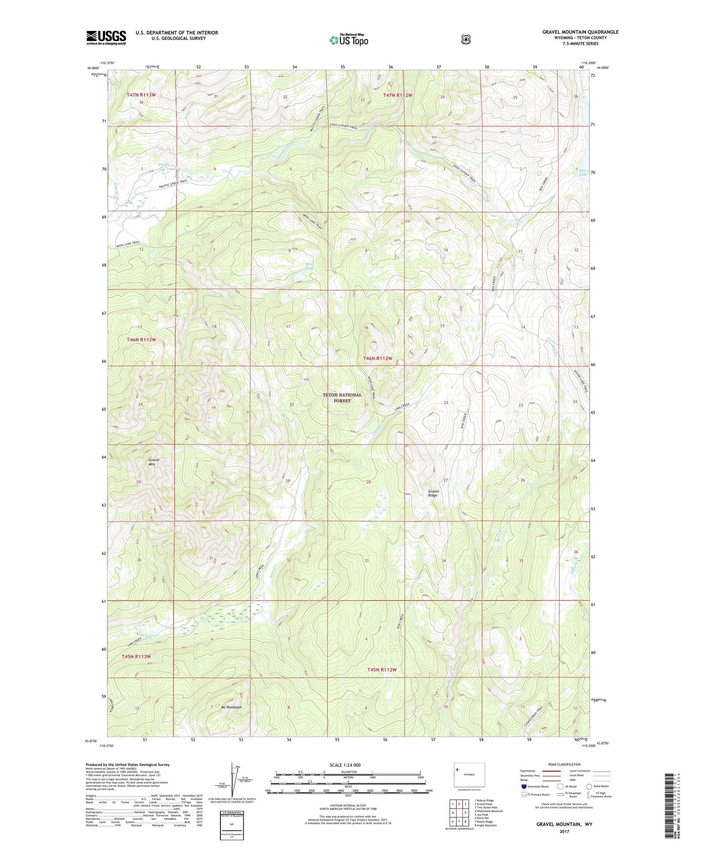
Gravel Mountain Wyoming US Topo Map
Couldn't load pickup availability
Also explore the Gravel Mountain Forest Service Topo of this same quad for updated USFS data
2021 topographic map quadrangle Gravel Mountain in the state of Wyoming. Scale: 1:24000. Based on the newly updated USGS 7.5' US Topo map series, this map is in the following counties: Teton. The map contains contour data, water features, and other items you are used to seeing on USGS maps, but also has updated roads and other features. This is the next generation of topographic maps. Printed on high-quality waterproof paper with UV fade-resistant inks.
Quads adjacent to this one:
West: Whetstone Mountain
Northwest: Bobcat Ridge
North: Gravel Peak
Northeast: Two Ocean Pass
East: Joy Peak
Southeast: Angle Mountain
South: Rosies Ridge
Southwest: Davis Hill
This map covers the same area as the classic USGS quad with code o43110h3.
Contains the following named places: Divide Trail, Enos Creek, Enos Creek Cutoff Trail, Enos Lake Patrol Cabin, Gravel Creek, Gravel Mountain, Gravel Ridge, Moss Lake, Moss Lake Trail, Mount Randolph