MyTopo
Chalk Hills Wyoming US Topo Map
Couldn't load pickup availability
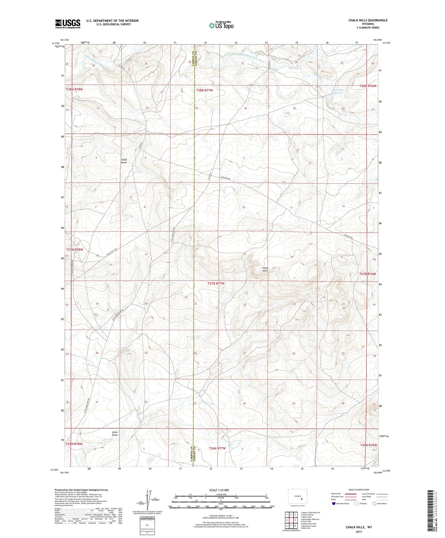
2021 topographic map quadrangle Chalk Hills in the state of Wyoming. Scale: 1:24000. Based on the newly updated USGS 7.5' US Topo map series, this map is in the following counties: Albany, Carbon. The map contains contour data, water features, and other items you are used to seeing on USGS maps, but also has updated roads and other features. This is the next generation of topographic maps. Printed on high-quality waterproof paper with UV fade-resistant inks.
Quads adjacent to this one:
West: Moss Agate Reservoir
Northwest: Bates Creek Reservoir
North: Squaw Spring
Northeast: Rock Creek
East: Pass Creek
Southeast: Boot Heel
South: Big Charlie Lakes
Southwest: Walker Draw NW
This map covers the same area as the classic USGS quad with code o42106c1.
Contains the following named places: AEC Anomaly Number Six Mine, AEC Anomaly Number Three Mine, Big Smith Number One Mine, Burnett Creek, Chalk Hills, Como Ridge Mine, Heward Ranch, Higgmson Homestead, Hurda Group Claims, Slate Draw, Three Mile Dam, Three Mile Reservoir, Threemile Creek