MyTopo
Fremont Peak North Wyoming US Topo Map
Couldn't load pickup availability
Also explore the Fremont Peak North Forest Service Topo of this same quad for updated USFS data
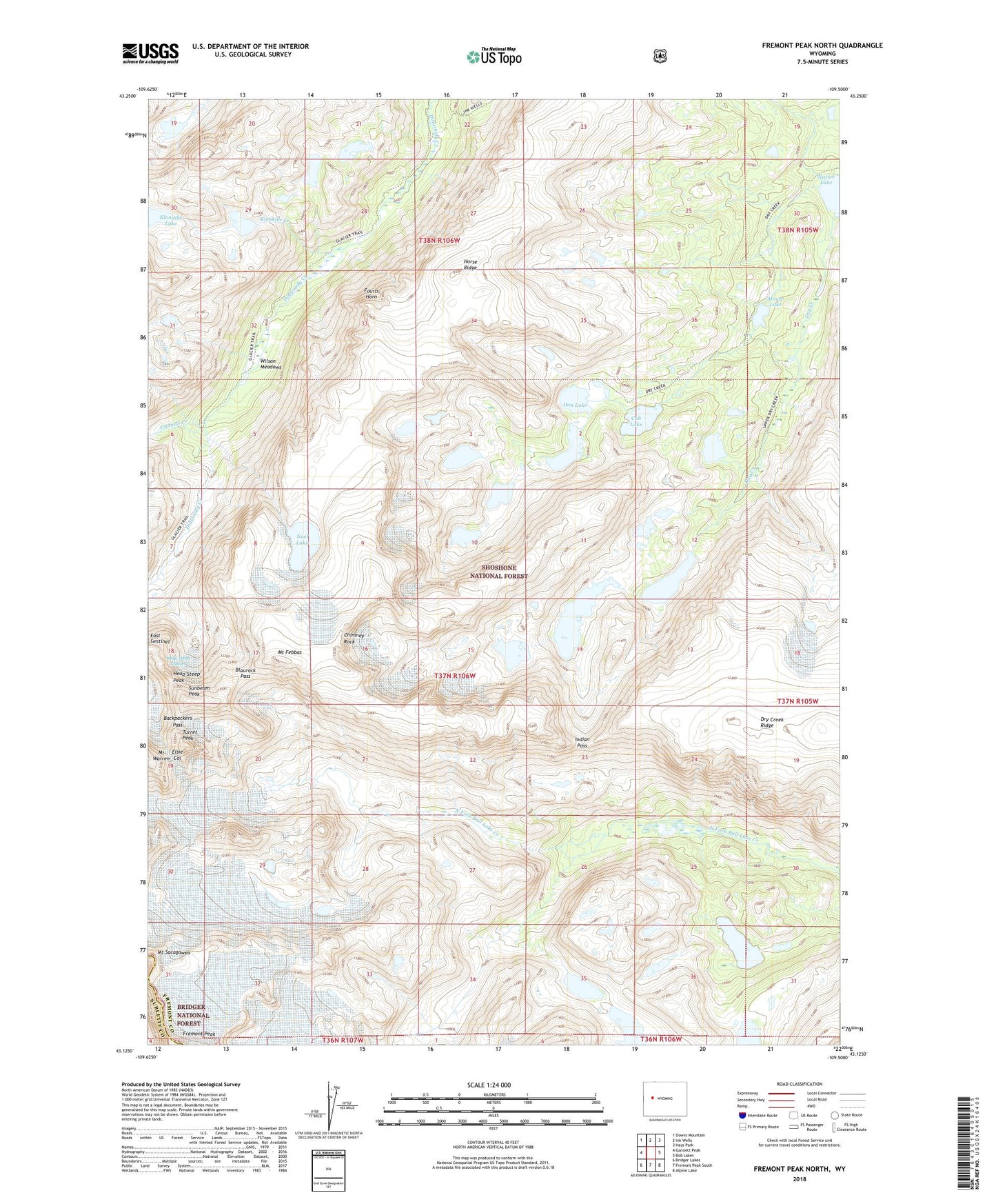
2021 topographic map quadrangle Fremont Peak North in the state of Wyoming. Scale: 1:24000. Based on the newly updated USGS 7.5' US Topo map series, this map is in the following counties: Fremont, Sublette. The map contains contour data, water features, and other items you are used to seeing on USGS maps, but also has updated roads and other features. This is the next generation of topographic maps. Printed on high-quality waterproof paper with UV fade-resistant inks.
Quads adjacent to this one:
West: Gannett Peak
Northwest: Downs Mountain
North: Ink Wells
Northeast: Hays Park
East: Bob Lakes
Southeast: Alpine Lake
South: Fremont Peak South
Southwest: Bridger Lakes
This map covers the same area as the classic USGS quad with code o43109b5.
Contains the following named places: Backpackers Pass, Blaurock Pass, Chimney Rock, Cub Lake, Don Lake, Dry Creek Ridge, East Sentinel, Elsie Col, Fourts Horn, Fremont Glaciers, Gannett Creek, Heap Steep Glacier, Heap Steep Peak, Helen Glacier, Horse Ridge, Indian Pass, Klondike Creek, Lower Fremont Glacier, Moose Lake, Mount Febbas, Mount Sacagawea, Native Lake, Noel Lake, Sacagawea Glacier, Sunbeam Peak, Turret Peak, Upper Fremont Glacier, Wilson Meadows