MyTopo
Caldwell Lake Wyoming US Topo Map
Couldn't load pickup availability
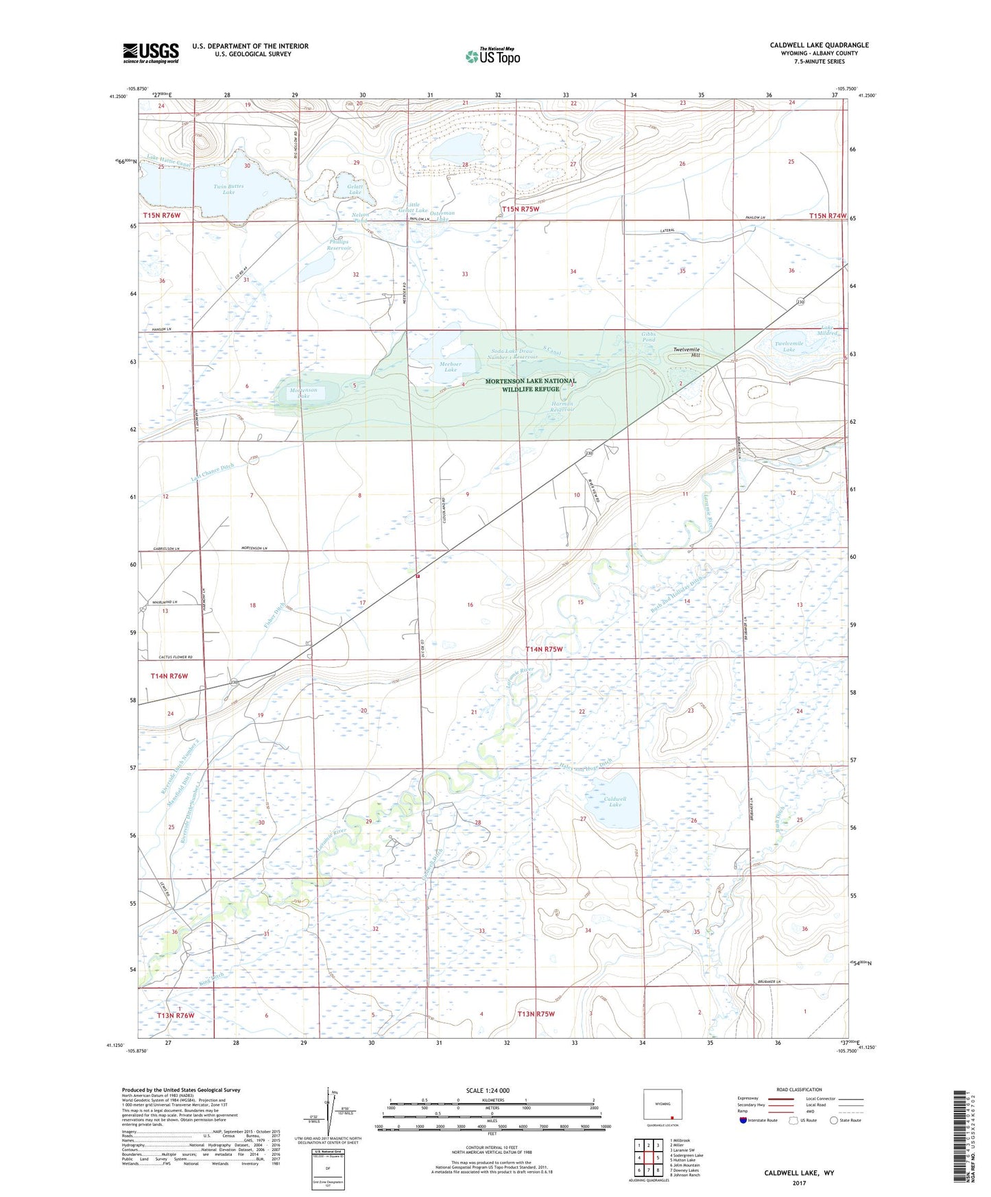
2021 topographic map quadrangle Caldwell Lake in the state of Wyoming. Scale: 1:24000. Based on the newly updated USGS 7.5' US Topo map series, this map is in the following counties: Albany. The map contains contour data, water features, and other items you are used to seeing on USGS maps, but also has updated roads and other features. This is the next generation of topographic maps. Printed on high-quality waterproof paper with UV fade-resistant inks.
Quads adjacent to this one:
West: Sodergreen Lake
Northwest: Millbrook
North: Miller
Northeast: Laramie SW
East: Hutton Lake
Southeast: Johnson Ranch
South: Downey Lakes
Southwest: Jelm Mountain
Contains the following named places: Bush and Holliday Ditch, Bush Ditch, Caldwell Ditch, Caldwell Lake, Gelatt Lake, Gibbs Pond, Haley and Hoge Ditch, Harman Dam, Harman Reservoir, Harmony, Hunzicker Ranch, King Ditch, Lake Hattie Canal, Lake Mildred, Last Chance Ditch, Leroy Bridge, Little Gelatt Lake, Mansfield Ditch, Meeboer Lake, Mortenson Lake, Mortenson Lake National Wildlife Refuge, Nelson Pond, Osterman Lake, Phillips Reservoir, Riverside Ditch Number 1, Riverside Ranch, Sand Creek Mine, Soda Lake, Soda Lake Draw Number 1 Dam, Soda Lake Draw Number 1 Reservoir, South Canal, Twelvemile Hill, Twelvemile Lake, Twin Buttes Lake, ZIP Code: 82070