MyTopo
Hutton Lake Wyoming US Topo Map
Couldn't load pickup availability
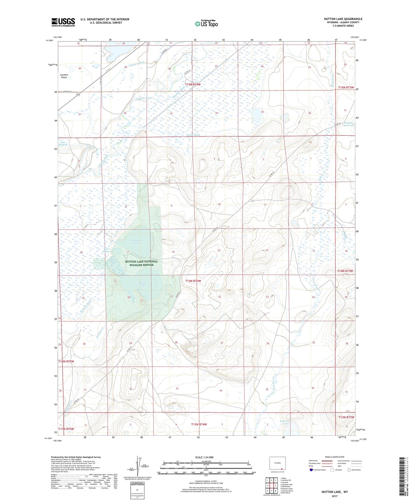
2021 topographic map quadrangle Hutton Lake in the state of Wyoming. Scale: 1:24000. Based on the newly updated USGS 7.5' US Topo map series, this map is in the following counties: Albany. The map contains contour data, water features, and other items you are used to seeing on USGS maps, but also has updated roads and other features. This is the next generation of topographic maps. Printed on high-quality waterproof paper with UV fade-resistant inks.
Quads adjacent to this one:
West: Caldwell Lake
Northwest: Miller
North: Laramie SW
Northeast: Laramie
East: Red Buttes
Southeast: Best Ranch
South: Johnson Ranch
Southwest: Downey Lakes
This map covers the same area as the classic USGS quad with code o41105b6.
Contains the following named places: Antelope Creek, Big Laramie Stage Station, Columbus Dam, Creighton Lake, Dowlin Ditch, Flag Ranch, Hutton Lake, Hutton Lake Dam Number 3, Hutton Lake National Wildlife Refuge, Lake George, Laramie Plains, Lone Tree Creek, Monolith Ditch, Pioneer Lateral, Rays Airpark, Richards Ditch, Rush Lake, Sand Creek, Sportsman Dam, Sportsman Lake Mine, Willow Creek