
MyTopo
Cassa Wyoming US Topo Map
Couldn't load pickup availability
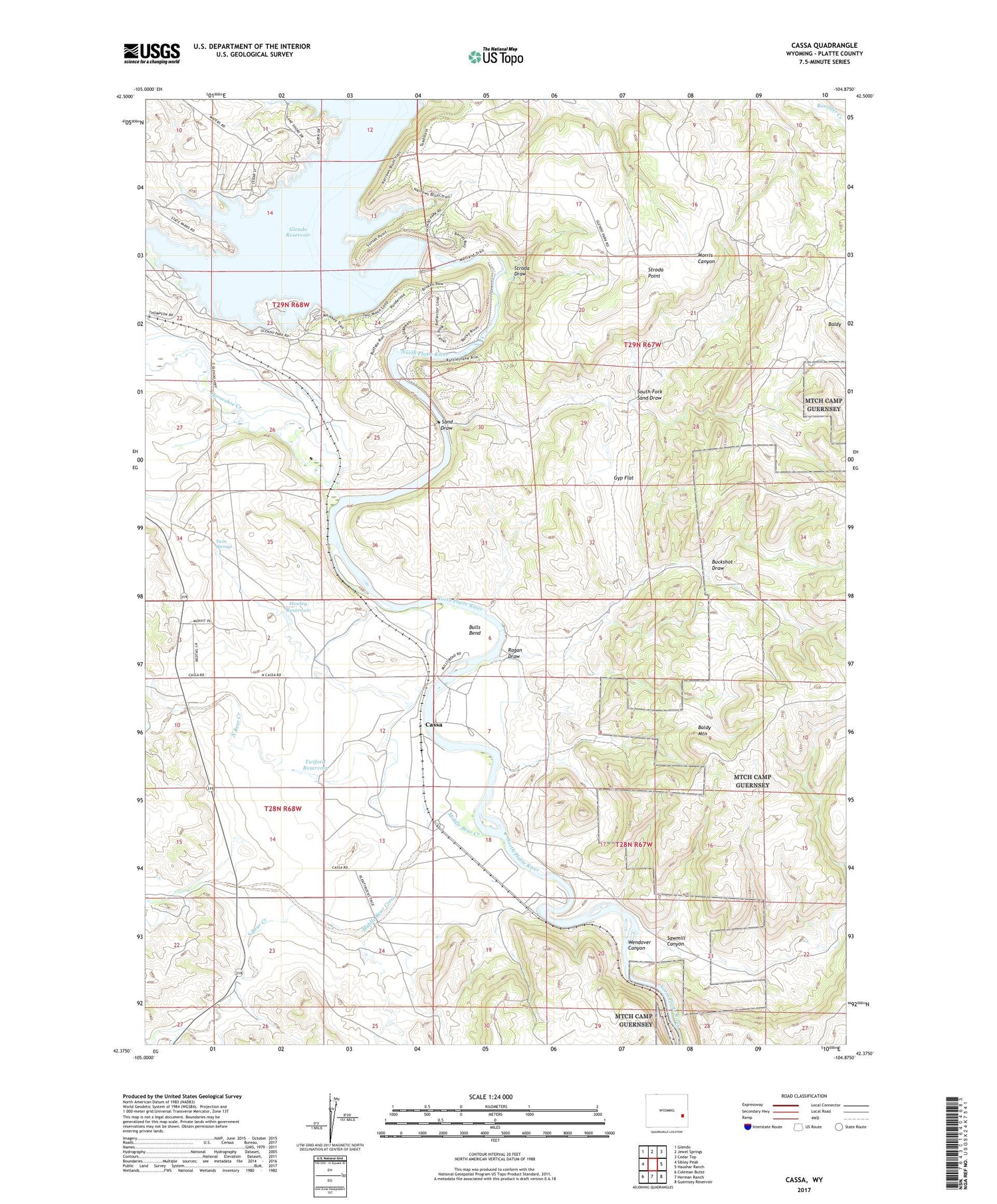
2021 topographic map quadrangle Cassa in the state of Wyoming. Scale: 1:24000. Based on the newly updated USGS 7.5' US Topo map series, this map is in the following counties: Platte. The map contains contour data, water features, and other items you are used to seeing on USGS maps, but also has updated roads and other features. This is the next generation of topographic maps. Printed on high-quality waterproof paper with UV fade-resistant inks.
Quads adjacent to this one:
West: Sibley Peak
Northwest: Glendo
North: Jewel Springs
Northeast: Cedar Top
East: Haushar Ranch
Southeast: Guernsey Reservoir
South: Herman Ranch
Southwest: Coleman Butte
Contains the following named places: Baldy, Baldy Mountain, Buckshot Draw, Bulls Bend, Cassa, Glendo Dam, Glendo Dike Number 1 Dam, Glendo Dike Number 2 Dam, Glendo Dike Number 3 Dam, Gyp Flat, Hooley Reservoir, Horseshoe Creek, Middle Bear Creek, North Bear Creek, Ragan Draw, Sand Draw, Sawmill Canyon, South Bear Creek, South Fork Sand Draw, Stroda Draw, Stroda Point, Twiford Dam, Twiford Reservoir, Twin Springs


