MyTopo
Jewel Springs Wyoming US Topo Map
Couldn't load pickup availability
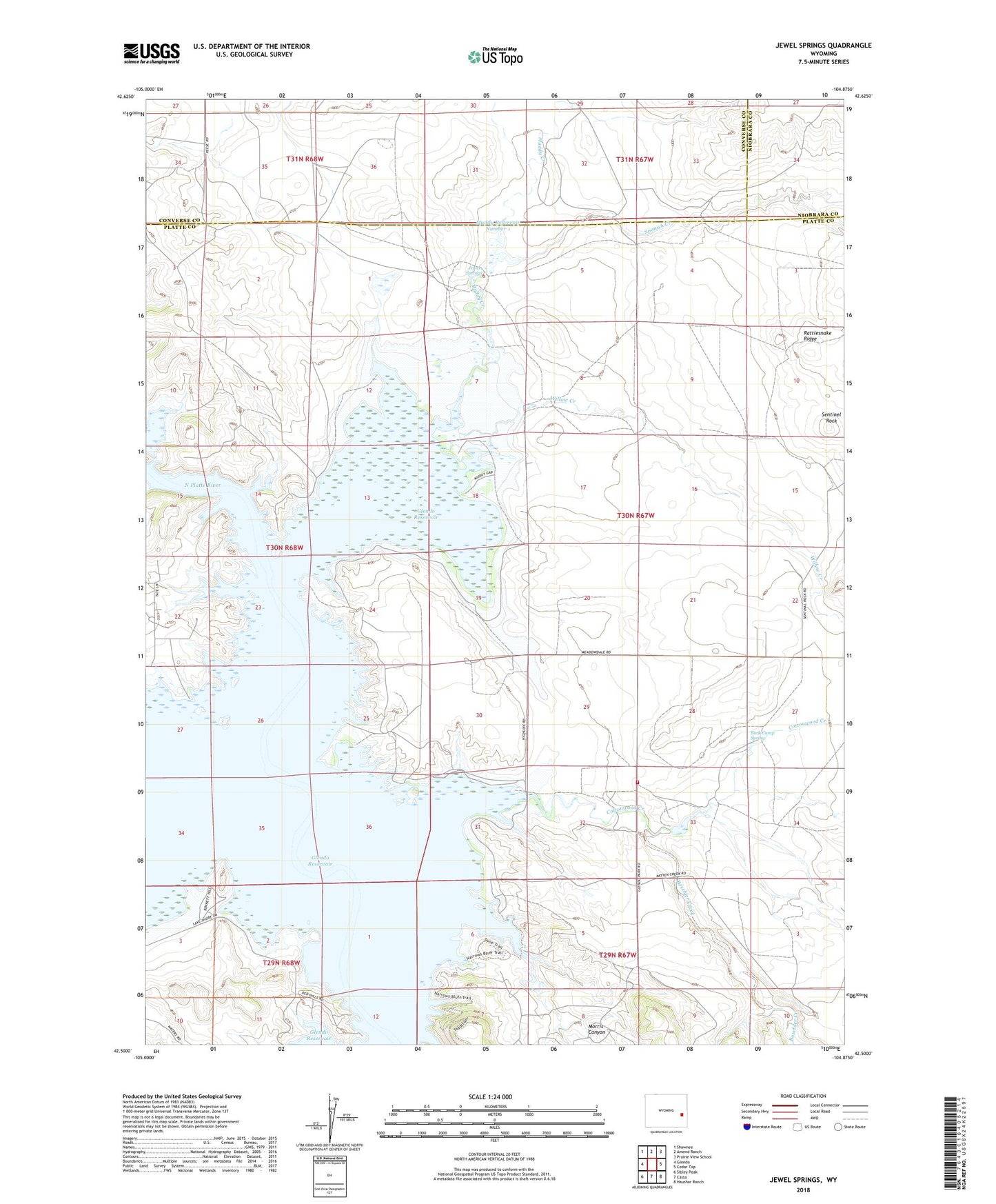
2021 topographic map quadrangle Jewel Springs in the state of Wyoming. Scale: 1:24000. Based on the newly updated USGS 7.5' US Topo map series, this map is in the following counties: Platte, Converse, Niobrara. The map contains contour data, water features, and other items you are used to seeing on USGS maps, but also has updated roads and other features. This is the next generation of topographic maps. Printed on high-quality waterproof paper with UV fade-resistant inks.
Quads adjacent to this one:
West: Glendo
Northwest: Shawnee
North: Amend Ranch
Northeast: Prairie View School
East: Cedar Top
Southeast: Haushar Ranch
South: Cassa
Southwest: Sibley Peak
This map covers the same area as the classic USGS quad with code o42104e8.
Contains the following named places: Boxelder Creek, Buck Camp Spring, Cottonwood Creek, Crandall Dam, Glendo Reservoir, Glendo State Park, Jewel Springs, Morris Canyon, Muddy Creek, Muddy Number 1 Dam, Muddy Reservoir Number 1, Platte County Rural Fire District 2F, Rattlesnake Ridge, Sentinel Rock, Spanish Creek, Willow Creek