MyTopo
Cedar Top Wyoming US Topo Map
Couldn't load pickup availability
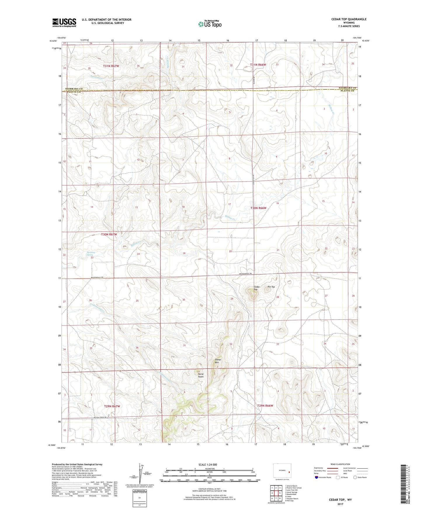
2021 topographic map quadrangle Cedar Top in the state of Wyoming. Scale: 1:24000. Based on the newly updated USGS 7.5' US Topo map series, this map is in the following counties: Platte, Niobrara. The map contains contour data, water features, and other items you are used to seeing on USGS maps, but also has updated roads and other features. This is the next generation of topographic maps. Printed on high-quality waterproof paper with UV fade-resistant inks.
Quads adjacent to this one:
West: Jewel Springs
Northwest: Amend Ranch
North: Prairie View School
Northeast: Lone Tree Hill
East: Meadowdale
Southeast: Hell Gap
South: Haushar Ranch
Southwest: Cassa
This map covers the same area as the classic USGS quad with code o42104e7.
Contains the following named places: Cedar Top, Cundall Dam, Cundall Reservoir, Horse Tooth, Pin Top, Sheep Mountain, Spanish Diggings, Spouting Spring