MyTopo
Castle Gardens Wyoming US Topo Map
Couldn't load pickup availability
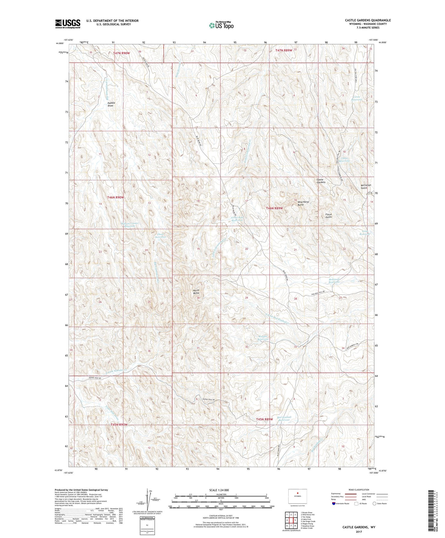
2021 topographic map quadrangle Castle Gardens in the state of Wyoming. Scale: 1:24000. Based on the newly updated USGS 7.5' US Topo map series, this map is in the following counties: Washakie. The map contains contour data, water features, and other items you are used to seeing on USGS maps, but also has updated roads and other features. This is the next generation of topographic maps. Printed on high-quality waterproof paper with UV fade-resistant inks.
Quads adjacent to this one:
West: Cabin Fork
Northwest: Broom Draw
North: Wild Horse Hill
Northeast: Ten Sleep
East: Joe Emge Creek
Southeast: Indian Creek
South: Deadline Draw
Southwest: Wagon Prong
Contains the following named places: Bedstead Reservoir, Bud Kimball Reservoir, Castle Reservoir, Chess Reservoir, Circle Reservoir, Green Bug Reservoir, Hubble Draw, Kimball Draw Mine, North Butte, Rice Number 3 Reservoir, Roughs Reservoir, Snap Reservoir, Tepee Pole Draw, The Honeycombs, Wild Horse Butte, Witness Corner Reservoir