MyTopo
Ten Sleep Wyoming US Topo Map
Couldn't load pickup availability
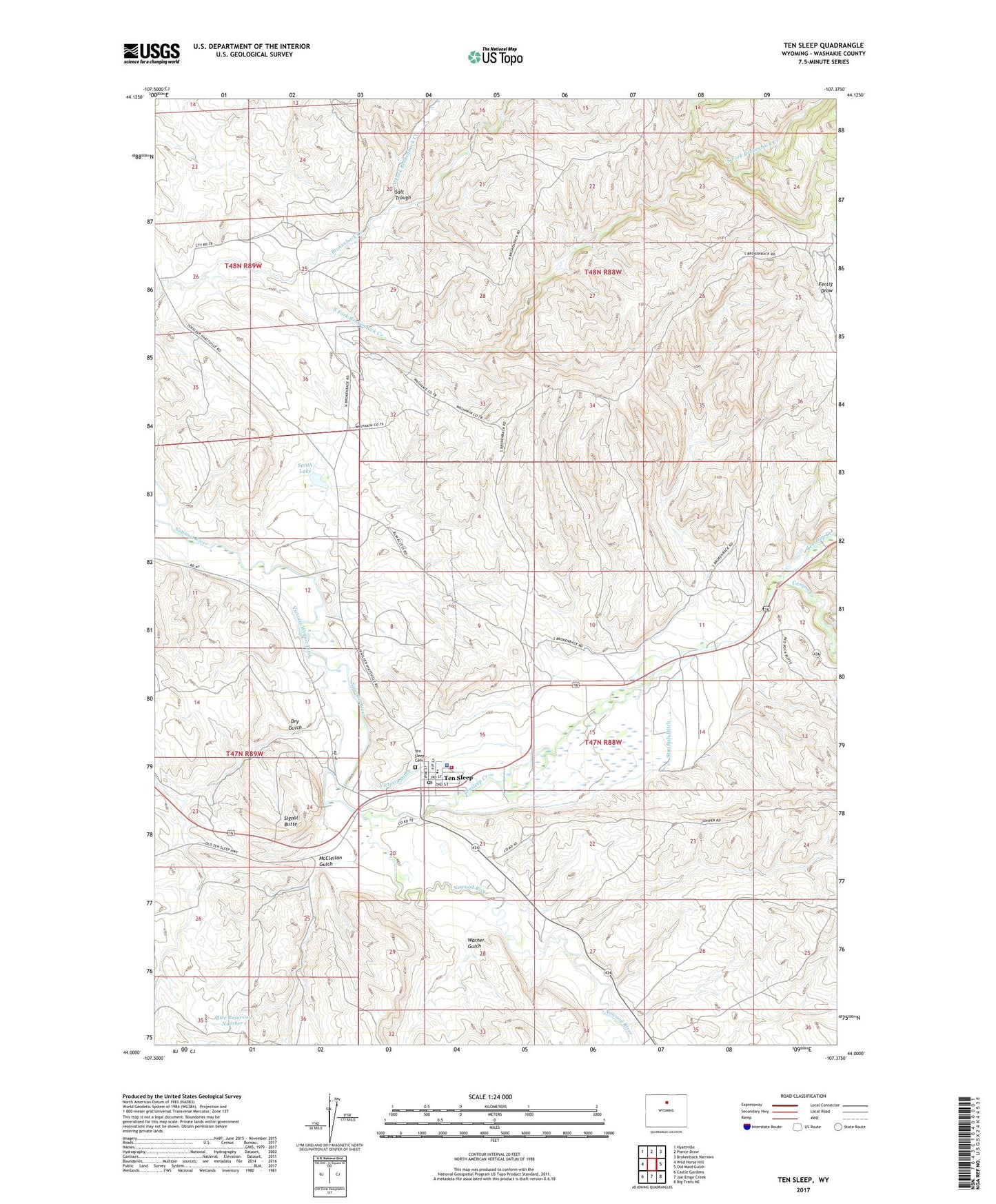
2021 topographic map quadrangle Ten Sleep in the state of Wyoming. Scale: 1:24000. Based on the newly updated USGS 7.5' US Topo map series, this map is in the following counties: Washakie. The map contains contour data, water features, and other items you are used to seeing on USGS maps, but also has updated roads and other features. This is the next generation of topographic maps. Printed on high-quality waterproof paper with UV fade-resistant inks.
Quads adjacent to this one:
West: Wild Horse Hill
Northwest: Hyattville
North: Pierce Draw
Northeast: Brokenback Narrows
East: Old Maid Gulch
Southeast: Big Trails NE
South: Joe Emge Creek
Southwest: Castle Gardens
This map covers the same area as the classic USGS quad with code o44107a4.
Contains the following named places: Canyon Creek, Dry Gulch, Fiscus and Vanoni Ditch, Frison Mine, J Smith Dam, J Smith Reservoir, McClellan Gulch, Mileski Mine, North Fork Brokenback Creek, Rice Reservoir Number 1, Salt Trough, Signal Butte, Smith Lake, South Fork Brokenback Creek, Standish Ditch, Ten Sleep, Ten Sleep Ambulance, Ten Sleep Area Mine, Ten Sleep Cemetery, Ten Sleep High School, Ten Sleep Middle School, Ten Sleep Post Office, Ten Sleep Rural Fire District, Ten Sleep School, Tensleep Canyon Mine, Tensleep Creek, Town of Ten Sleep, Victoria Ditch, Victoria Winsor Ditch, Warner Gulch, Washakie County Sheriff's Office, Wigwam Fish Rearing Station