MyTopo
Broom Draw Wyoming US Topo Map
Couldn't load pickup availability
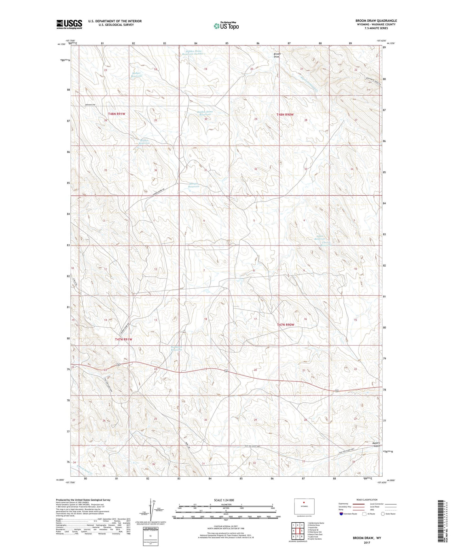
2021 topographic map quadrangle Broom Draw in the state of Wyoming. Scale: 1:24000. Based on the newly updated USGS 7.5' US Topo map series, this map is in the following counties: Washakie. The map contains contour data, water features, and other items you are used to seeing on USGS maps, but also has updated roads and other features. This is the next generation of topographic maps. Printed on high-quality waterproof paper with UV fade-resistant inks.
Quads adjacent to this one:
West: Worland SE
Northwest: McDermotts Butte
North: Weintz Draw
Northeast: Hyattville
East: Wild Horse Hill
Southeast: Castle Gardens
South: Cabin Fork
Southwest: Banjo Flats East
This map covers the same area as the classic USGS quad with code o44107a6.
Contains the following named places: Badger Reservoir, Broom Draw, Charco Reservoir, Cottonwood Creek Oil and Gas Field, Hanger Reservoir, Hidden Dome Oil and Gas Field, Hidden Dome Reservoir, Hidden Dome Reservoir Number 1, Hidden Reservoir, Pumpjack Reservoir, Silted Reservoir