MyTopo
Wild Horse Hill Wyoming US Topo Map
Couldn't load pickup availability
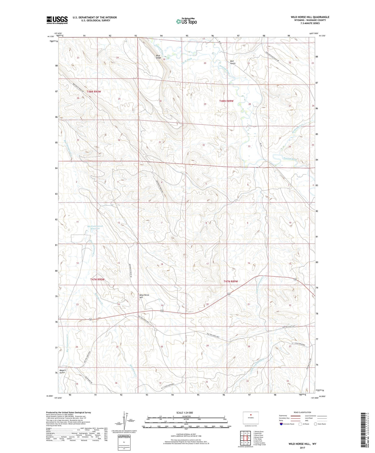
2021 topographic map quadrangle Wild Horse Hill in the state of Wyoming. Scale: 1:24000. Based on the newly updated USGS 7.5' US Topo map series, this map is in the following counties: Washakie. The map contains contour data, water features, and other items you are used to seeing on USGS maps, but also has updated roads and other features. This is the next generation of topographic maps. Printed on high-quality waterproof paper with UV fade-resistant inks.
Quads adjacent to this one:
West: Broom Draw
Northwest: Weintz Draw
North: Hyattville
Northeast: Pierce Draw
East: Ten Sleep
Southeast: Joe Emge Creek
South: Castle Gardens
Southwest: Cabin Fork
This map covers the same area as the classic USGS quad with code o44107a5.
Contains the following named places: Big Cottonwood Reservoir, Blue Ridge, Brokenback Creek, Buffalo Creek, Davis Pit Number Two Mine, Little Cottonwood Creek, Meyers Gulch, Occidental Well, Packer Group Mine, Red Gulch, The West Ditch, Wild Horse Creek, Wild Horse Hill