MyTopo
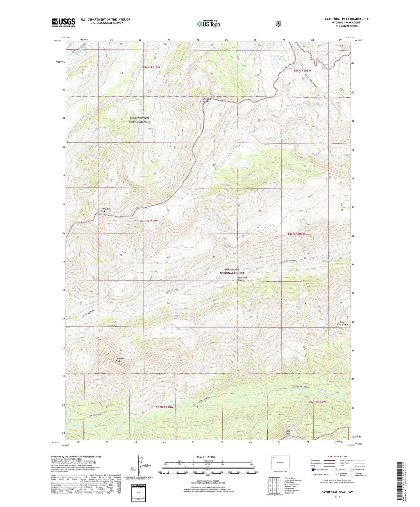
Cathedral Peak Wyoming US Topo Map
Couldn't load pickup availability
Also explore the Cathedral Peak Forest Service Topo of this same quad for updated USFS data
2021 topographic map quadrangle Cathedral Peak in the state of Wyoming. Scale: 1:24000. Based on the newly updated USGS 7.5' US Topo map series, this map is in the following counties: Park. The map contains contour data, water features, and other items you are used to seeing on USGS maps, but also has updated roads and other features. This is the next generation of topographic maps. Printed on high-quality waterproof paper with UV fade-resistant inks.
Quads adjacent to this one:
West: Mount Chittenden
Northwest: Pelican Cone
North: Little Saddle Mountain
Northeast: Pollux Peak
East: Pahaska Tepee
Southeast: Eagle Creek
South: Plenty Coups Peak
Southwest: Sylvan Lake
This map covers the same area as the classic USGS quad with code o44110e1.
Contains the following named places: Cathedral Peak, Cody Peak, Frost Lake, Giant Castle Mountain, Pyramid Peak, Silvertip Peak