MyTopo
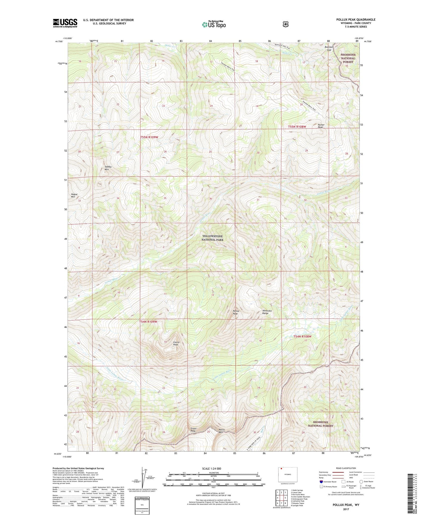
Pollux Peak Wyoming US Topo Map
Couldn't load pickup availability
Also explore the Pollux Peak Forest Service Topo of this same quad for updated USFS data
2021 topographic map quadrangle Pollux Peak in the state of Wyoming. Scale: 1:24000. Based on the newly updated USGS 7.5' US Topo map series, this map is in the following counties: Park. The map contains contour data, water features, and other items you are used to seeing on USGS maps, but also has updated roads and other features. This is the next generation of topographic maps. Printed on high-quality waterproof paper with UV fade-resistant inks.
Quads adjacent to this one:
West: Little Saddle Mountain
Northwest: Wahb Springs
North: Canoe Lake
Northeast: Hurricane Mesa
East: Stinkingwater Peak
Southeast: Sunlight Peak
South: Pahaska Tepee
Southwest: Cathedral Peak
This map covers the same area as the classic USGS quad with code o44109f8.
Contains the following named places: Bootjack Gap, Castor Peak, Grant Peak, Notch Mountain, Parker Peak, Pollux Peak, Saddle Mountain, Upper Lamar River Patrol Station, Upper Miller Creek Patrol Station