MyTopo
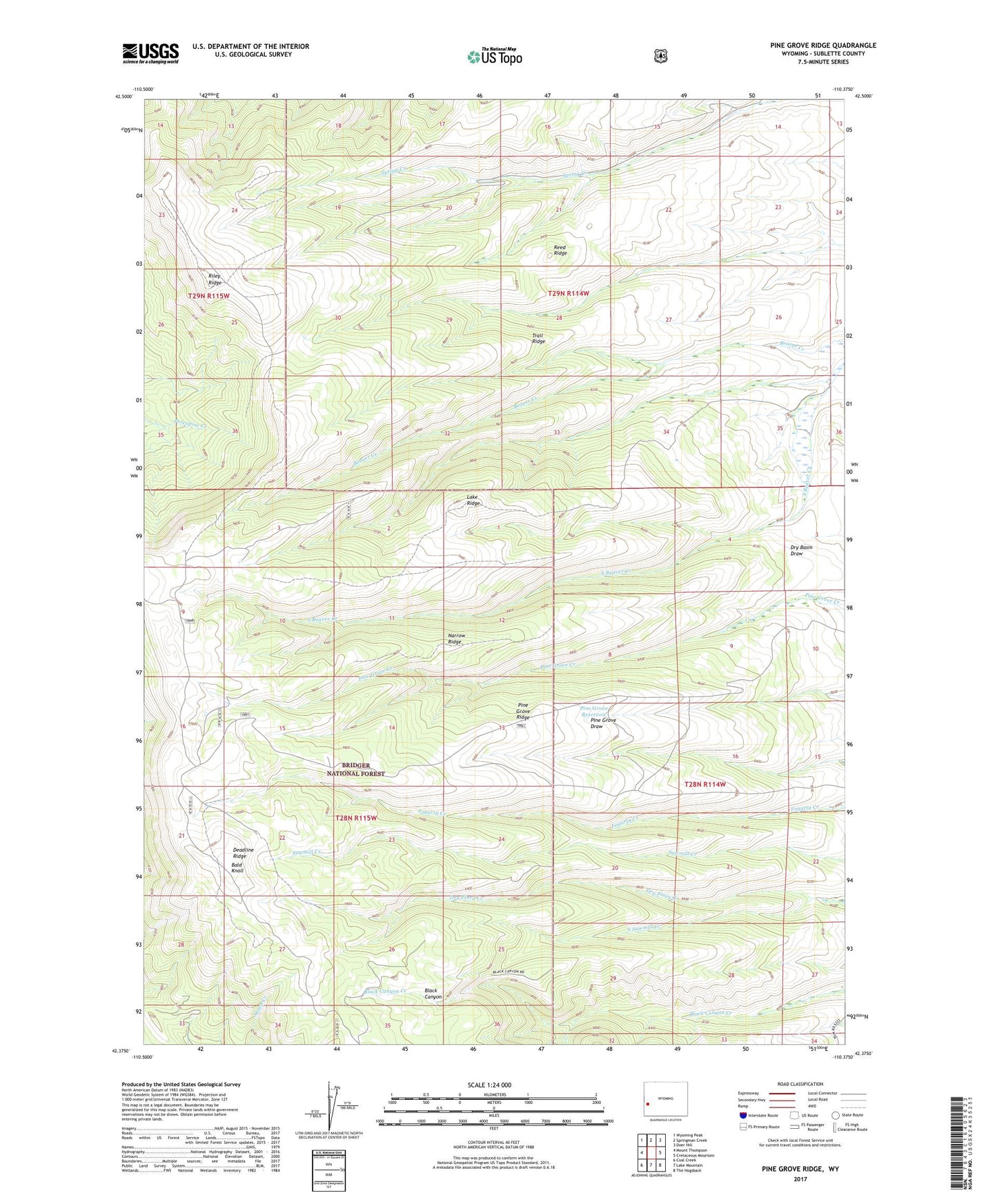
Pine Grove Ridge Wyoming US Topo Map
Couldn't load pickup availability
Also explore the Pine Grove Ridge Forest Service Topo of this same quad for updated USFS data
2021 topographic map quadrangle Pine Grove Ridge in the state of Wyoming. Scale: 1:24000. Based on the newly updated USGS 7.5' US Topo map series, this map is in the following counties: Sublette. The map contains contour data, water features, and other items you are used to seeing on USGS maps, but also has updated roads and other features. This is the next generation of topographic maps. Printed on high-quality waterproof paper with UV fade-resistant inks.
Quads adjacent to this one:
West: Mount Thompson
Northwest: Wyoming Peak
North: Springman Creek
Northeast: Deer Hill
East: Cretaceous Mountain
Southeast: The Hogsback
South: Lake Mountain
Southwest: Coal Creek
This map covers the same area as the classic USGS quad with code o42110d4.
Contains the following named places: Bald Knoll, Lake Ridge, Narrow Ridge, Pine Grove Reservoir, Pine Grove Ridge, Reed Ridge, Riley Ridge, South Sawmill Creek, Trail Ridge