MyTopo
Colter Bay Wyoming US Topo Map
Couldn't load pickup availability
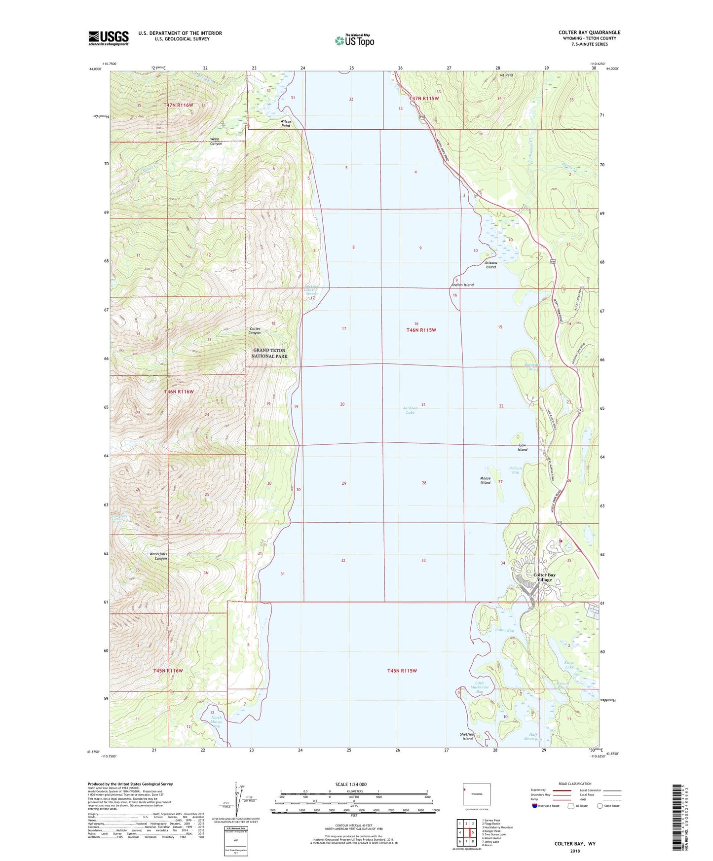
2021 topographic map quadrangle Colter Bay in the state of Wyoming. Scale: 1:24000. Based on the newly updated USGS 7.5' US Topo map series, this map is in the following counties: Teton. The map contains contour data, water features, and other items you are used to seeing on USGS maps, but also has updated roads and other features. This is the next generation of topographic maps. Printed on high-quality waterproof paper with UV fade-resistant inks.
Quads adjacent to this one:
West: Ranger Peak
Northwest: Survey Peak
North: Flagg Ranch
Northeast: Huckleberry Mountain
East: Two Ocean Lake
Southeast: Moran
South: Jenny Lake
Southwest: Mount Moran
Contains the following named places: Arizona Creek, Arizona Island, Bailey Creek, Berry Creek, Colter Bay, Colter Bay Post Office, Colter Bay Village, Colter Canyon, Columbine Cascade, Cow Island, Grand Teton National Park / Colter Bay Fire Department, Half Moon Bay, Heron Pond, Indian Island, Jackson Lake, Jackson Lake Hot Springs, Leeks Lodge, Little Mackinaw Bay, Moose Creek, Moose Island, Mount Reid, North Moran Bay, Pelican Bay, Sargents Bay, Sheffield Island, Swan Lake, Waterfalls Canyon, Watkins Ditch, Webb Canyon, Webb Canyon Trail, Wilcox Point