MyTopo
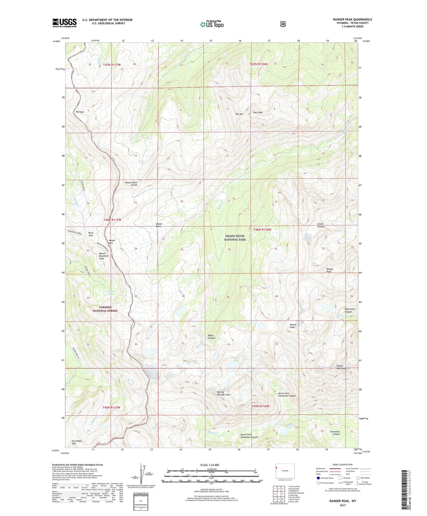
Ranger Peak Wyoming US Topo Map
Couldn't load pickup availability
Also explore the Ranger Peak Forest Service Topo of this same quad for updated USFS data
2021 topographic map quadrangle Ranger Peak in the state of Wyoming. Scale: 1:24000. Based on the newly updated USGS 7.5' US Topo map series, this map is in the following counties: Teton. The map contains contour data, water features, and other items you are used to seeing on USGS maps, but also has updated roads and other features. This is the next generation of topographic maps. Printed on high-quality waterproof paper with UV fade-resistant inks.
Quads adjacent to this one:
West: Rammell Mountain
Northwest: Hominy Peak
North: Survey Peak
Northeast: Flagg Ranch
East: Colter Bay
Southeast: Jenny Lake
South: Mount Moran
Southwest: Granite Basin
This map covers the same area as the classic USGS quad with code o43110h7.
Contains the following named places: Camp Lake, Camp Lake Trail, Doane Peak, Dudley Lake, Eagles Rest Peak, Elk Mountain, Moose Basin, Moose Basin Divide, Moose Mountain, Moose Mountain Slide, Nord Pass, North Fork Snowshoe Canyon, Owl Creek Trail, Owl Peak, Ranger Peak, Red Mountain, Rolling Thunder Mountain, South Fork Snowshoe Canyon, Talus Lake, Wilderness Falls